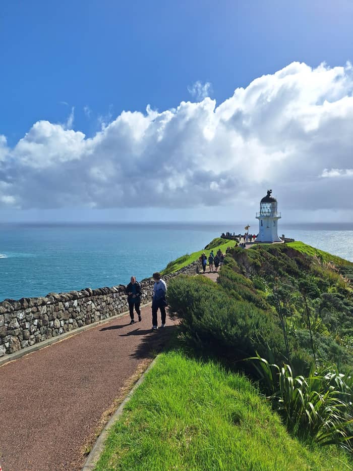
Drives the beach
Coach on the sand
Paihia day trip
- Length11 hours
- Vehicle46-seat bus
- Depends onTides and weather
Where is your stop
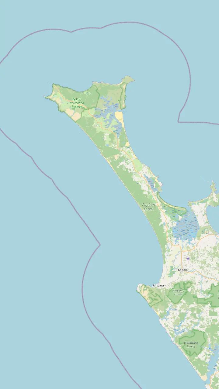
Map of 18 stops
First pick a route, then tap any pin or stop for details and Google Maps.
The popular vehicle exit from Ninety Mile Beach, open to 4WD vehicles only.
Google MapsGiant dunes around 150 m high, used for sandboarding; dogs are not permitted.
Google MapsA beach on the coastal track west of the cape where DOC has reported feral dogs.
Google MapsA beach landmark 51 km south of Te Paki Stream, where the Ngāti Kuri rohe meets the coast.
Google MapsA beach landmark 69 km south of Te Paki Stream.
Google MapsThe town at the southern end of the beach, known for sunsets and surf.
Google Maps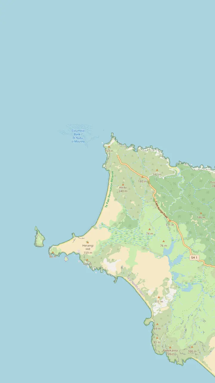
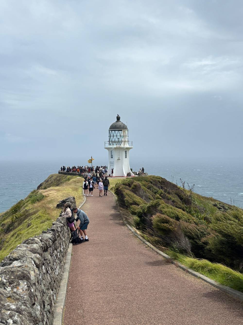
The white tower stands 165m above the sea at the end of an 800 m paved path from the car park.
Google MapsThe tip of the headland with the pōhutukawa Te Aroha; no food is eaten here.
Google MapsA long beach west of the cape, reached by a 2 km return track past steep cliffs.
Google MapsThe headland west of the lighthouse, named by Abel Tasman for the wife of the Governor of Batavia.
Google MapsThe island where the first northern light stood; the stump of its old tower remains.
Google MapsA campsite bay managed by Ngāti Kuri, the place DOC suggests for eating.
Google Maps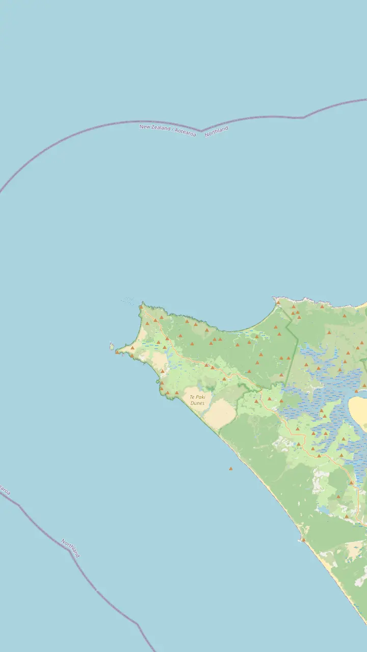
The white tower stands 165m above the sea at the end of an 800 m paved path from the car park.
Google MapsThe tip of the headland with the pōhutukawa Te Aroha; no food is eaten here.
Google MapsThe island where the first northern light stood; the stump of its old tower remains.
Google MapsThe headland west of the lighthouse, named by Abel Tasman for the wife of the Governor of Batavia.
Google MapsKapowairua, a bay with a DOC campsite at the eastern end of the coastal track.
Google MapsA campsite bay managed by Ngāti Kuri, the place DOC suggests for eating.
Google Maps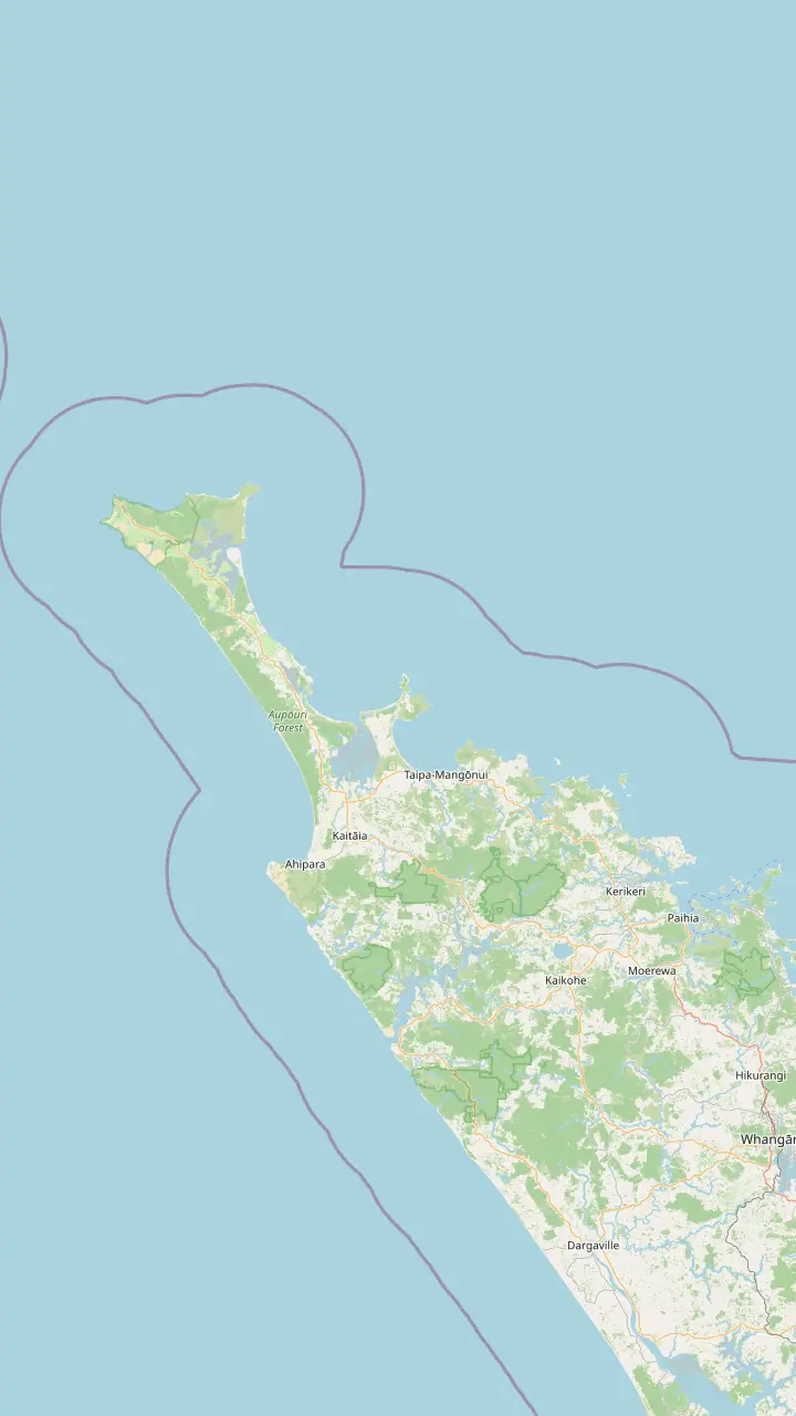
Bay of Islands town where the coach day to Cape Reinga starts.
Google MapsThe last major town before the top of the country, approximately 111 km south of the cape.
Google MapsA harbor settlement on the road north toward the cape.
Google MapsA small settlement on the road north, before Waitiki Landing.
Google MapsThe junction where the last 20 km of road to the cape begins.
Google MapsThe white tower stands 165m above the sea at the end of an 800 m paved path from the car park.
Google Maps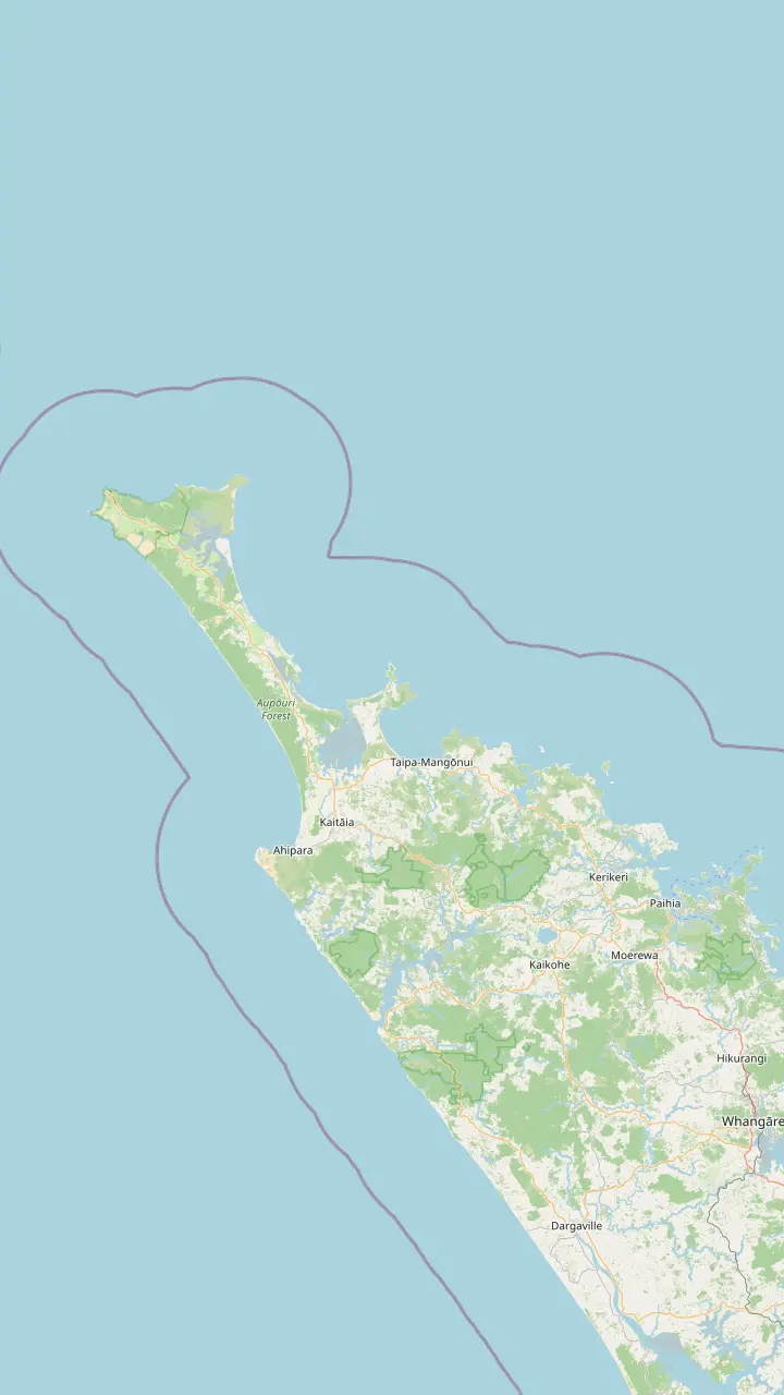
Bay of Islands town where the coach day to Cape Reinga starts.
Google MapsThe last major town before the top of the country, approximately 111 km south of the cape.
Google MapsThe town at the southern end of the beach, known for sunsets and surf.
Google MapsA small settlement on the road north, before Waitiki Landing.
Google MapsA campsite bay managed by Ngāti Kuri, the place DOC suggests for eating.
Google MapsKapowairua, a bay with a DOC campsite at the eastern end of the coastal track.
Google MapsThe junction where the last 20 km of road to the cape begins.
Google MapsMap data by © OpenStreetMap contributors
Ninety Mile Beach at Cape Reinga is a highway made of sand, run by the tide. Here is how long it really is, who may drive it, where the coaches leave the beach and what to look for along the way.
Editorial team, capereingatour.top · Updated November 8, 2026 · A 8 min read
The name oversells the distance. Tourism New Zealand describes the beach as running from Ahipara to Scott Point, a little south of Cape Maria van Diemen, and puts its real length at 88 kilometres.1 Northland Inc gives the same figure in miles, 55 miles or 88km, so the name is a legend rather than a measurement.4 On a gray day it feels endless anyway. Bring a jacket: the wind off the Tasman rarely lets up.
Its Māori name is Te Oneroa-a-Tōhē, and the official sources write both names side by side. The sand belongs to a long story: Northland Inc says the beach matters deeply to local people and deserves respect on every visit.5 The Ngāti Kuri rohe begins at Hukatere on this coast and runs north to Te Rerenga Wairua.6 You are driving through someone's home, not across an empty playground.
What surprises most visitors is the legal status. Tourism New Zealand notes the beach is officially a highway, yet in practice suited only to 4WD vehicles and safe only at certain stages of the tide.2 That is the whole story of Ninety Mile Beach at Cape Reinga in one line: it is open to traffic, and it can still swallow a car. The rest of this guide is about reading that tension well.
Who can drive
| Vehicle | On the sand | Why |
|---|---|---|
| Rental car | Not allowed | Hire companies forbid it |
| Own 4WD | At the right tide | Safe only at set times |
| Ordinary car | Not advised | Cars get caught by waves |
| Coach tour | Tides permitting | Purpose-built beach bus |
| Te Paki Stream | 4WD vehicles only | DOC rule for the stream |
Rules and advice from Tourism New Zealand, Northland Inc, DOC and the tour listing.2,10,11
If you picked up a hire car in Auckland, the decision is made for you. Hire firms bar their vehicles from the sand, mostly on safety grounds, according to Tourism New Zealand, which suggests a coach tour as the easy way to drive the beach.2 Check your own contract before you go. A breakdown on the sand is also far from any help.
Northland Inc puts it more bluntly: it does not recommend driving on the beach if you do not know the terrain, because plenty of cars have been caught by the waves.10 At the northern exit, DOC limits Te Paki Stream to 4WD vehicles only.11 Soft sand, a rising tide and a quickening stream are a bad mix for a hatchback with road tires. Leave the beach driving to people who do it every day.
That is why the coach day sells. The Paihia trip on this site uses a purpose-built 46-seat bus that drives on 90 Mile Beach, on a full day of 11 hours. Its listing is honest that travel on the beach and the sandboarding stop are subject to tides and weather, so the beach leg can change on the day. Riding 90 Mile Beach to Cape Reinga as a passenger lets you watch the surf instead of the sand ahead.
Measured on foot
Distances along the beach as DOC gives them for walkers continuing from Te Paki Stream.9
Everything on this coast runs on the tide. Tourism New Zealand describes the beach as safe to drive only at specific tide times, which is why coach timetables on the sand move from day to day.2 If you are planning a walk or a fishing trip, the hours either side of low tide near Cape Reinga give you the widest, firmest strip of sand to work with. Wet sand near the water is firm; dry sand higher up is soft.
Official tide predictions come from Land Information New Zealand, which publishes daily tables listing the times and heights of high and low waters.12 One detail catches people out in summer: LINZ adjusts those times to New Zealand Daylight Time while daylight saving is in force.13 Check the date on the table and the location it covers before you trust it, and leave a generous margin.
DOC's advice for the coastal track applies on the beach too. Carry tide charts, because waves can wash over parts of the route at high tide and in rough seas.14 Some streams cannot be crossed around high tide, and you may have to wait for the water to drop.15 Build that waiting time into any plan, and never race an incoming tide to save a few minutes. A wet foot is fine; a car in the surf is not.
Pick your way
The vehicle you have decides more than the weather does.
If I have a rental car
Take a coach for the sand
Hire firms do not allow cars on the beach.2
If I want to ride the sand
Book the beach bus
The Paihia day uses a bus built to drive 90 Mile Beach.
If I want a quiet walk
Go near low tide
The beach is firmest and widest then; check the LINZ tables.12
If I have my own 4WD
Learn the tide first
It is safe only at specific tide times.2
If I want the culture
Join the iwi-hosted day
Ngāti Kuri members host a small-group day.
Ways to see it
Drives the beach
Paihia day trip
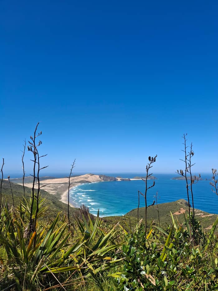
Walks the south end
From Paihia or Kaitaia
Cultural focus
Hosted by the iwi
DOC lists the distances south from Te Paki Stream for walkers on Te Araroa, and they make a handy mental map of the beach. Wakatehaua Island, also called The Bluff, is 19 km away; Hukatere is 51 km; Waipapakauri is 69 km; and Ahipara is 83 km.9 Those markers are the places people mean when they talk about getting on or off the beach. Note them down before you lose the phone signal.
Ahipara anchors the southern end. Northland Inc places it 14km southwest of Kaitaia, at the south end of the beach.37 Tourism New Zealand praises its sunsets and one of the best left-hand surf breaks in the country.7 It makes a good base for anyone who wants to see the beach slowly, on foot or on a horse, rather than at coach speed. Book a bed there early if you want a sunset on the beach, then drive north the next morning.
Further north, the dunes thicken and the road network thins. The Te Hiku o te Ika-a-Māui journey that Northland Inc promotes starts at Te Kōhanga Shipwreck Bay near Ahipara and follows the coast north until the land runs out.38 Seen from a map, the beach is the western spine of that route, with State Highway 1 running parallel inland. Fuel up in Kaitaia before you head north, and carry water and snacks.
Price the beach
Pick a group size to compare beach day prices.
Compare 3 alternatives
Pick a group size to compare beach day prices.
≈
View≈
View≈
ViewAll amounts are from-prices on GetYourGuide, converted at the ECB reference rate. Exact prices are shown at booking.
North along the sand
Ahipara
Sunsets and a left-hand surf break.7
Shipwreck Bay
Old hulls show when the tide is out.8
Waipapakauri
69 km south of Te Paki Stream.9
Hukatere
The rohe line meets the coast here.6
The Bluff
19 km south of Te Paki Stream.9
Te Paki Stream
Cars and tourist buses leave the beach here.3
At the northern end, most traffic leaves the sand at Te Paki Stream. DOC describes it as a popular vehicle entrance and exit for the beach, used by cars and tourist buses, and warns walkers to be ready for them.3 The stream bed itself is open to 4WD vehicles only, which is part of why the crossing feels like an adventure.11 Expect wheel ruts and wet patches in the stream bed, and step aside early.
The stream runs out between the giant Te Paki dunes, so the exit doubles as the sandboarding stop for many tours. DOC strongly advises against sliding down any dune that leads into the stream where vehicles drive, because of the risk of being hit.34 If you visit by car, use the car park at the end of Te Paki Stream Road and walk in rather than driving onto the sand.39 Shoes you can empty of sand are a gift on the way back.
For walkers heading inland, DOC says following the stream through the dunes from the beach takes about another 1 hr 30 min to the parking area and toilets.40 Soft sand makes it slower than it looks. Pack extra water, since soft sand is thirsty walking, and watch for vehicles in the stream bed, which can appear quickly around the bends. Turn back early if the stream is running high after rain.
Video
Peg and Rob's Game For Adventure on YouTube · Until you tap play, no video is loaded.
The beach is of extreme importance to local people and needs to be respected at all times.
Before the sand
The beach has long been a working road. DOC records that cattle from the Te Paki station were herded in annual musters into one large mob and walked the length of Ninety Mile Beach to the freezing works at Moerewa.41 Picture the dust and noise of that drive the next time a coach rolls past you on the hard sand near the waterline. Little of that working past shows today, but the scale of the beach makes it easy to imagine.
At the southern end, Northland Inc says the Ahipara area was known for kauri gum digging in the late 19th century.42 Te Kōhanga Shipwreck Bay, at the southern point near Ahipara, has wrecks that show at low tide and is popular with surfers.8 It is worth timing a visit to the bay with the tide table, for the same reasons that rule the whole beach. Leave anything you find where it lies.
Fishing is part of the culture here too. Northland Inc counts the beach among the best-known fishing spots in the country and suggests a sunset horse ride along the sand with Ahipara Horse Treks.43,44 Whatever brings you, treat the beach as the locals do: as a place with its own rules, its own history and its own people. Take only photographs and leave the sand exactly as you found it.
For Te Araroa walkers, the beach is a long first stretch. DOC's coastal track notes say you can carry on from Te Paki Stream along Te Oneroa-a-Tōhē all the way to Ahipara.45 Walking the whole length is a multi-day effort, so most visitors settle for an hour on the sand near either end, which is plenty to feel the scale of the place. Even a short walk shows how wide the sky is here.
A few hazards are easy to miss. DOC has reported feral dogs near Twilight Beach and Scott's Point, including Ninety Mile Beach, and advises against walking that area alone.31 Rogue waves and ocean surges are a risk for anyone fishing or walking close to the water.35 Keep children well back from the wash, and keep an eye on the sea even when it looks calm. A stick and a whistle are sensible company on a long walk.
Phone coverage in Te Paki is thin, so let someone know your route and your expected return time.36 If you join the Cape Reinga 90 Mile Beach tour instead of driving, the guide and driver carry that responsibility for you. You get the beach leg without the stress. Either way, give the tide the last word on your plans. There is always another tide tomorrow, and another chance to see the beach at its best.
FAQ
Hire companies keep their cars off the sand, Tourism New Zealand says.2
It is officially a highway but suited only to 4WD vehicles at certain tide times.2
Tourism New Zealand says it is safe to drive only at specific times of the tide.2
DOC calls Te Paki Stream a popular entrance and exit used by cars and tourist buses.3
Its listing names a 46-seat bus that drives on 90 Mile Beach, subject to tides and weather.
LINZ publishes daily tables of high and low water times and heights.12
Sources
Heading for the top of the North Island? Ask a real person here.