Tour base
Paihia
For the coach day
- BedsWide choice
- TourStarts in town
- To the capeLong day
Where is your stop
The short version
For Cape Reinga, stay in Paihia for the coach tour, in Kaitaia or Ahipara if driving, or camp at Tapotupotu, since camping at the cape itself is not allowed.
Stay essentials
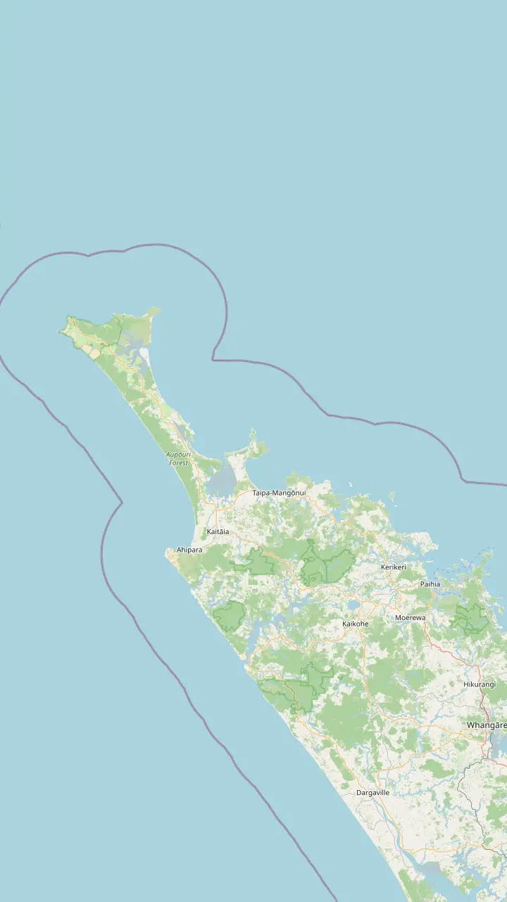
Map of 18 stops
First pick a route, then tap any pin or stop for details and Google Maps.
Bay of Islands town where the coach day to Cape Reinga starts.
Google MapsThe last major town before the top of the country, approximately 111 km south of the cape.
Google MapsThe town at the southern end of the beach, known for sunsets and surf.
Google MapsA small settlement on the road north, before Waitiki Landing.
Google MapsA campsite bay managed by Ngāti Kuri, the place DOC suggests for eating.
Google MapsKapowairua, a bay with a DOC campsite at the eastern end of the coastal track.
Google MapsThe junction where the last 20 km of road to the cape begins.
Google Maps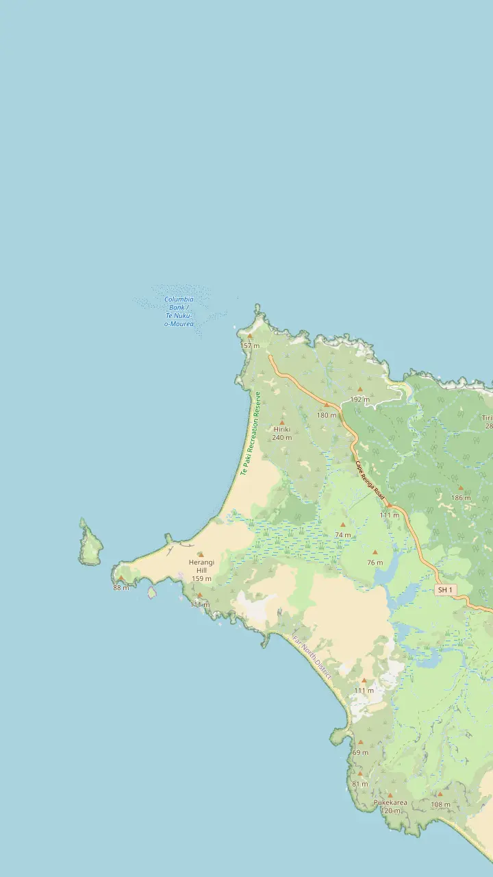
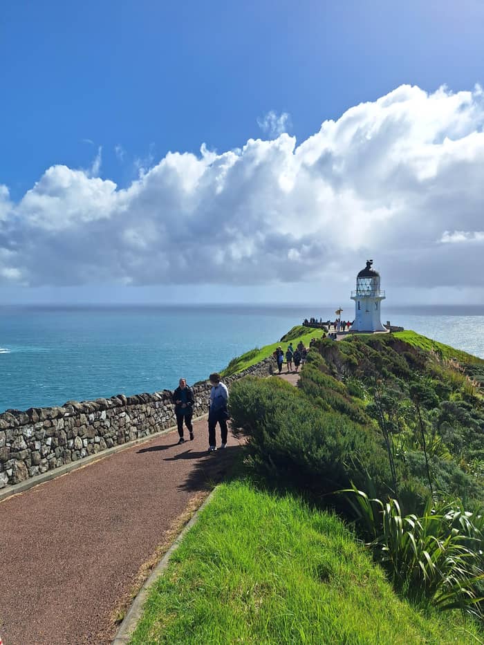
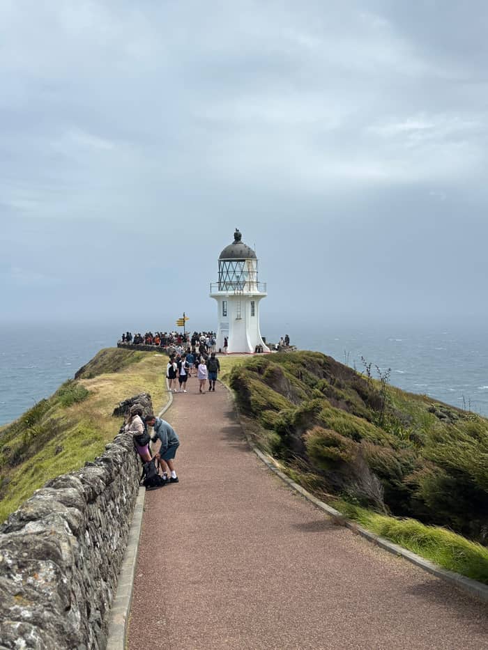
The white tower stands 165m above the sea at the end of an 800 m paved path from the car park.
Google MapsThe tip of the headland with the pōhutukawa Te Aroha; no food is eaten here.
Google MapsA long beach west of the cape, reached by a 2 km return track past steep cliffs.
Google MapsThe headland west of the lighthouse, named by Abel Tasman for the wife of the Governor of Batavia.
Google MapsThe island where the first northern light stood; the stump of its old tower remains.
Google MapsA campsite bay managed by Ngāti Kuri, the place DOC suggests for eating.
Google Maps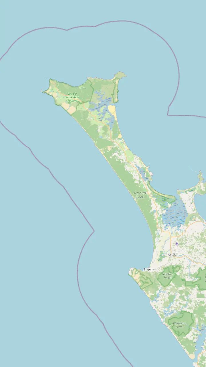
The popular vehicle exit from Ninety Mile Beach, open to 4WD vehicles only.
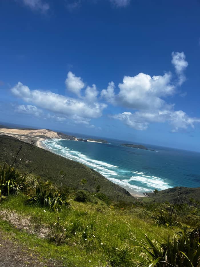
Google MapsGiant dunes around 150 m high, used for sandboarding; dogs are not permitted.
Google MapsA beach on the coastal track west of the cape where DOC has reported feral dogs.
Google MapsA beach landmark 51 km south of Te Paki Stream, where the Ngāti Kuri rohe meets the coast.
Google MapsA beach landmark 69 km south of Te Paki Stream.
Google MapsThe town at the southern end of the beach, known for sunsets and surf.
Google Maps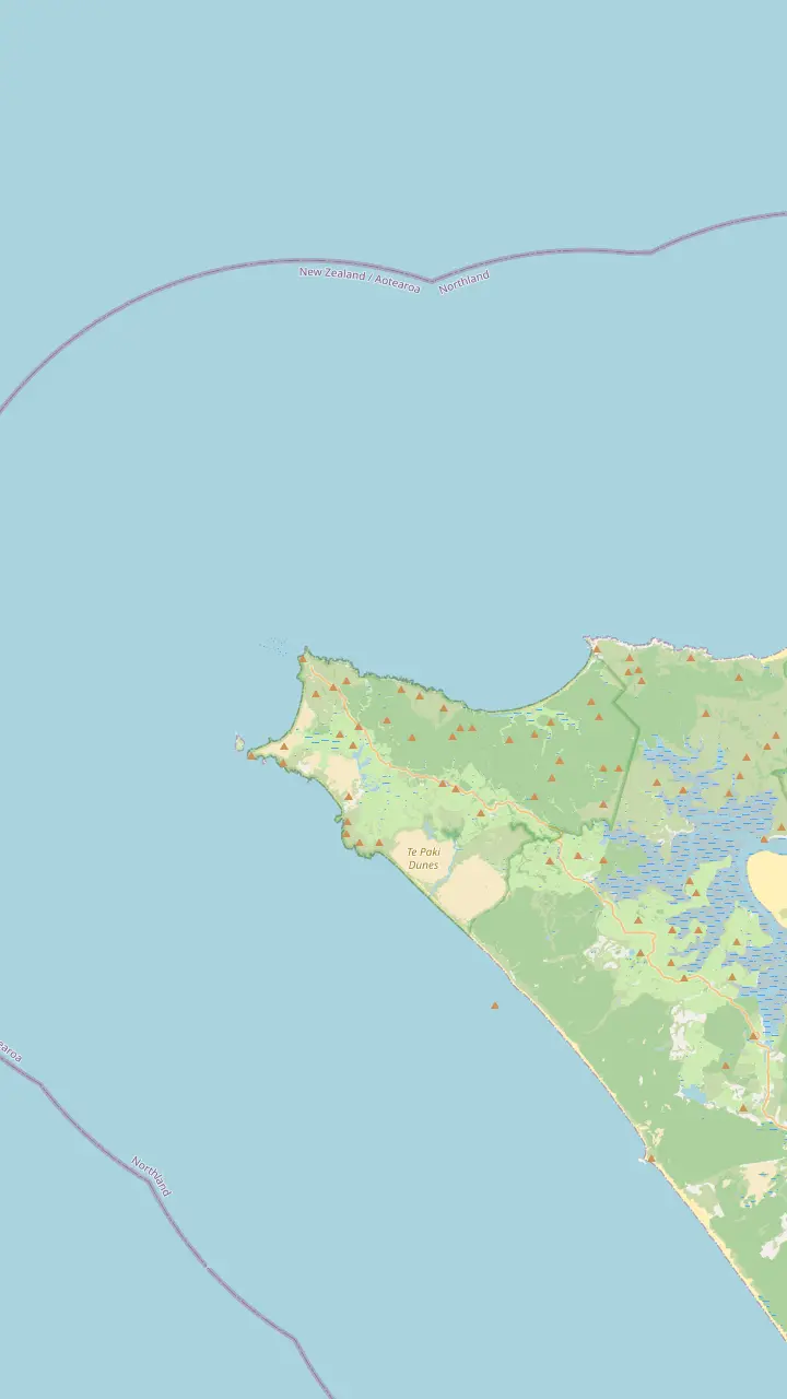
The white tower stands 165m above the sea at the end of an 800 m paved path from the car park.
Google MapsThe tip of the headland with the pōhutukawa Te Aroha; no food is eaten here.
Google MapsThe island where the first northern light stood; the stump of its old tower remains.
Google MapsThe headland west of the lighthouse, named by Abel Tasman for the wife of the Governor of Batavia.
Google MapsKapowairua, a bay with a DOC campsite at the eastern end of the coastal track.
Google MapsA campsite bay managed by Ngāti Kuri, the place DOC suggests for eating.
Google Maps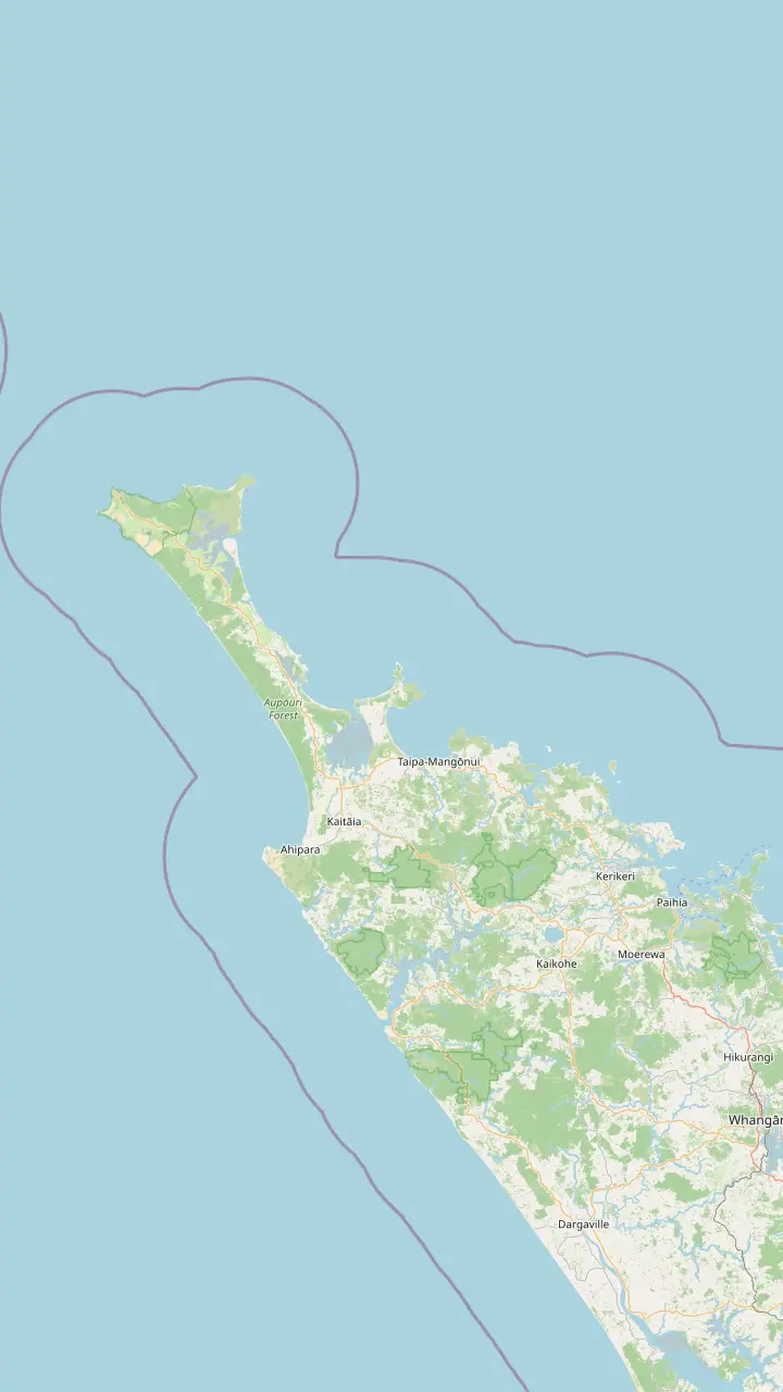
Bay of Islands town where the coach day to Cape Reinga starts.
Google MapsThe last major town before the top of the country, approximately 111 km south of the cape.
Google MapsA harbor settlement on the road north toward the cape.
Google MapsA small settlement on the road north, before Waitiki Landing.
Google MapsThe junction where the last 20 km of road to the cape begins.
Google MapsThe white tower stands 165m above the sea at the end of an 800 m paved path from the car park.
Google MapsMap data by © OpenStreetMap contributors
Nobody sleeps at the cape itself, but the choice of base shapes the whole trip. Compare the towns, the campsites near the top and the rules for campervans.
Editorial team, capereingatour.top · Updated November 8, 2026 · A 7 min read
Cape Reinga is a sacred place, and the land around it is protected. The Department of Conservation says no camping is allowed at the cape, and points visitors to the campground at Tapotupotu instead, which the local iwi Ngāti Kuri manage.1 The car park gates close at night, between 8.30pm and 7am, so even a quiet night in a van is off the table.6
That leaves a choice between a base further south and a campsite close to the top. The towns have hotels, motels and holiday homes but put you a long drive from the lighthouse. The campsites put you minutes away but offer little more than a tent pitch, a cold shower and a beach.7 Between them sit a few small settlements on the road north, such as Pukenui and Waitiki Landing, shown on the map; check what is open there before you rely on them, since services on the peninsula are limited.8
Which kind of Cape Reinga accommodation suits you depends on how you are travelling. If you are joining a tour, your bed should be where the tour starts. If you are driving, a bed near the top lets you beat the crowds, as the department advises, by arriving at either end of the day.9 The map above marks the towns and campsites discussed below.
Bases compared
| Base | What is there | Tour start | To the cape |
|---|---|---|---|
| Paihia | Wide choice of beds3 | Coach day | Via Kaitaia |
| Kaitaia | Small range of beds16 | Summer tours17 | About 1.5 hours18 |
| Ahipara | Campground, motel, homes16 | Via Kaitaia | 14km to Kaitaia19 |
| Tapotupotu | Tent sites, cold shower7 | None | 5 minutes2 |
| Kapowairua | Tent sites, no fires20 | None | Via Waitiki Landing21 |
Campsite rules and bookings change: check with DOC before you travel.10
If you are joining the coach day, Paihia is the obvious base. In the view of Tourism New Zealand it makes a superb base for the bay, with plenty of places to sleep and eat.3 The coach day leaves from the operator office in Paihia, so a room within walking distance makes the early start painless. Breakfast cafes open early along the waterfront, and the bay itself is a fine sight before a long day on the road.
The drawback is distance. Paihia is 118 km from Kaitaia, and Kaitaia is still 111 km from the cape.13,4 Add the return and the stops, and you can see how the coach day fills 11 hours. If you are searching for Cape Reinga hotels, it helps to know that the realistic hotel choice for this tour is Paihia, not the far north.
Paihia also gives you the Bay of Islands on the days around the tour: cruises from the wharf, the ferry to Russell and the Treaty Grounds at Waitangi.14,15 Book your bed and the tour together, and keep the evening after the tour free for rest. You will be back late, sandy and tired, and a short stroll to dinner on the waterfront is about as much as you will want after a day like that.
A night at the top
Kaitaia is the gateway to the far north for Tourism New Zealand and the supply centre for the regional agency.23,11 It has a small range of accommodation options, according to Northland Inc.16 The cape is roughly 1.5 hours up the road from there.18 Staying here takes well over an hour off each end of a self-drive day compared with Paihia, and puts the supermarkets and fuel of the last real town right on your doorstep.
Ahipara, 14km southwest of Kaitaia, sits at the south end of Ninety Mile Beach.19 Northland Inc lists a campground, a motel and plenty of holiday homes there.16 Tourism New Zealand praises its sunsets and its surf, and at low tide wrecks show in Shipwreck Bay.24,25 It is a relaxed seaside village rather than a town, a calm spot for the night before an early run north, with the sand on its doorstep.
Both towns suit drivers and summer tour-goers. Tours to the cape and Ninety Mile Beach leave Kaitaia in summer, according to Northland Inc.17 Outside summer, check whether your chosen tour runs from town on your date before you book a Kaitaia bed around it. For drivers, either town is a sensible halfway house between the Bay of Islands and the cape, and a night here turns the long return trip into a gentle pair of days instead of a single hard push.
Find your base
Match your trip to a row to see where to sleep.
If I am taking the coach day
Paihia
The coach day starts at the operator office in town.
If I am driving and want an early start
Kaitaia or Ahipara
From Kaitaia the cape is about 1.5 hours away.18
If I want to wake up near the lighthouse
Tapotupotu campsite
The campsite is 5 minutes by car from the cape car park.2
If I have a campervan
A designated campsite
Freedom camping is not allowed in DOC recreation reserves.5
If I want beaches and services for kids
Doubtless Bay
Its settlements have safe sandy beaches and beachfront stays.22
Three kinds of stay
Tour base
For the coach day
Closer
For drivers
At the top
For campers
Tapotupotu Bay is the place to sleep if you want to wake up near the lighthouse. The Department of Conservation describes a campsite by a lagoon good for swimming and kayaking, 5 minutes by car from the cape or 3 hours on the walking track.2 Its facilities are basic: 45 tent sites without power, a cold shower, non-flush toilets and tap water to boil before use.7
Fees are NZD 18 per night for an adult and NZD 9 for a child aged 5 to 17, and the DOC Campsite Pass is not accepted.45 Bookings are required, the Department of Conservation says on its walk page, while its campsite page says it is not taking bookings for now.1,10 Check the current position with the department or the iwi before you travel.
Camp managers are on site from December to February and at Easter.50 Wasps are common from January to April, and the beach is a challenging place to swim, with help more than an hour away.44,49 Open fires and fireworks are banned all year, though gas cookers are allowed, and no domestic animals may enter the Te Paki Recreation Reserve.12,48
Further east, Kapowairua at Spirits Bay is the other campsite in the area. The Department of Conservation describes it as bookable, with 45 tent sites and no fires at any time, set between a beach a 5 min walk away and the hills of the Aupōuri Peninsula.20,51 It is reached from Waitiki Landing by Te Hapua Road and Spirits Bay Road, about 16 km.21
Both Tapotupotu and Kapowairua lie on the Te Paki Coastal Track, which runs from Spirits Bay past the cape to Te Paki Stream.52 The whole track is 48 km, with 4 campsites along the way, and walkers may continue down Ninety Mile Beach to Ahipara.53,52 You can drive in, pitch a tent and walk a section of the track as a day trip, returning to the same camp at night.
For a campsite holiday, these pitches feel a world away, and the department calls Tapotupotu the most northern campsite in New Zealand.54 Bring everything you need, from food and water treatment to insect repellent and a mosquito-proof tent, which the department recommends for the sandflies and mosquitoes.55 Phones may not work, since reception in Te Paki is limited.46
Video
TRAVELLING TINY NZ on YouTube · Until you tap play, no video is loaded.
Scenic and recreation reserves: You cannot freedom camp in DOC-administered scenic or recreation reserves unless a designated campsite is provided or approved by DOC.
Camping checklist
Free camping near Cape Reinga is tightly limited. The Department of Conservation rules out freedom camping in the scenic and recreation reserves it runs, except at campsites it has designated or approved.5 Te Paki is a recreation reserve, and the campsites listed above are the designated places to stay.48
Rules for self-contained vehicles are also changing. From 7 June 2026, a vehicle needs a green warrant to be certified self-contained, and vehicles with a portable toilet no longer qualify.56 Check your campervan certification before you head north, and look for signs that restrict camping to certified vehicles. If your van does not qualify, plan your nights at Tapotupotu, Kapowairua or a holiday park in town rather than hoping to find a quiet roadside spot.
Motorhome waste has a home too. You can empty tanks where Te Paki Stream Road meets State Highway 1, or behind the Te Ahu Centre in Kaitaia, the nearest dump stations the department lists.57 At the cape there are no rubbish bins at all, so carry your waste back out with you.47 Plan the route so that you empty tanks on the way in or out, and keep grey water off the beaches and out of the streams.
On the coach day, sleep in Paihia: the tour starts in town and lasts 11 hours, and you will want a short walk to bed afterwards. On a small-group day, look at the pickup list, which takes in the visitor centre in the bay and a fuel station in Taipa, and sleep close to your stop. Read the confirmation for the exact pickup time, which tends to be early, and choose a bed you can leave quietly at that hour.
Driving yourself, split the trip with a night in Kaitaia or Ahipara, then head for the cape early in the morning. If you camp, Tapotupotu puts you 5 minutes from the lighthouse for a sunrise or a late visit before the gates close.2,6 Pack for wind and rain even in summer, as the weather at the top changes fast.58
Families who want beaches and services may prefer Doubtless Bay, whose settlements Northland Inc describes as having safe sandy beaches and beachfront accommodation.22 It lies east of Kaitaia, on the way between the Bay of Islands and the far north. It works well as a stop on the way up or back, especially for a family that needs a swim and an early night between long drives.
FAQ
No camping is allowed at the cape; the nearest campground is Tapotupotu, managed by Ngāti Kuri.1
Children aged 5 to 17 pay NZD 9; the DOC Campsite Pass is not accepted.45
DOC says you cannot freedom camp in its recreation reserves unless at a designated campsite.5
The coach day leaves from the operator office in Paihia and lasts 11 hours.
There is a dump station there, and another at the Te Ahu Centre car park in Kaitaia.57
Sources
Heading for the top of the North Island? Ask a real person here.