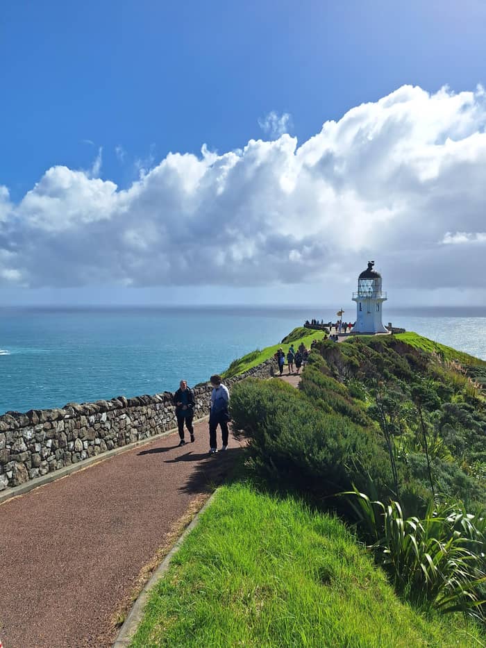
Classic view
Lighthouse rail
End of the paved path
- From car park800 m
- Time10 min
- LookWest to the bank
Where is your stop
Map of 18 stops
First pick a route, then tap any pin or stop for details and Google Maps.
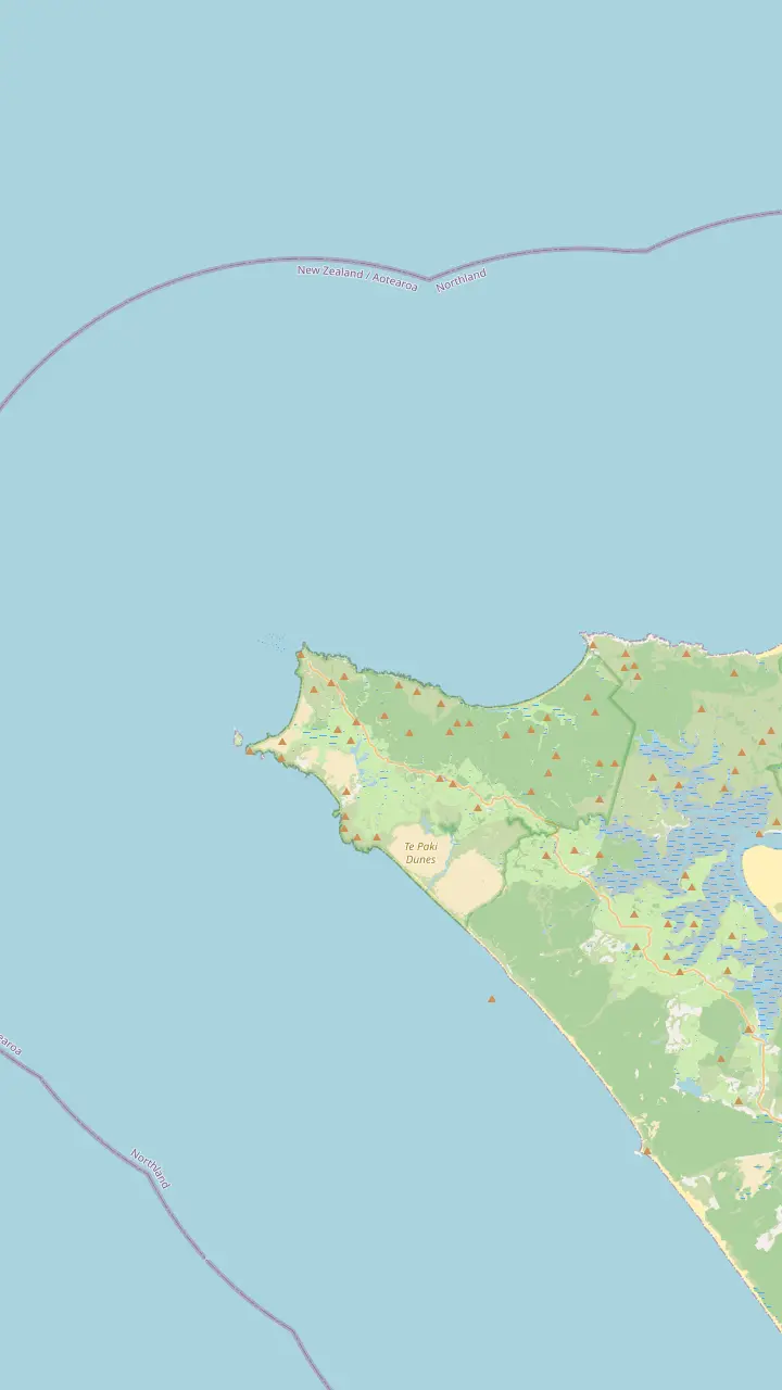
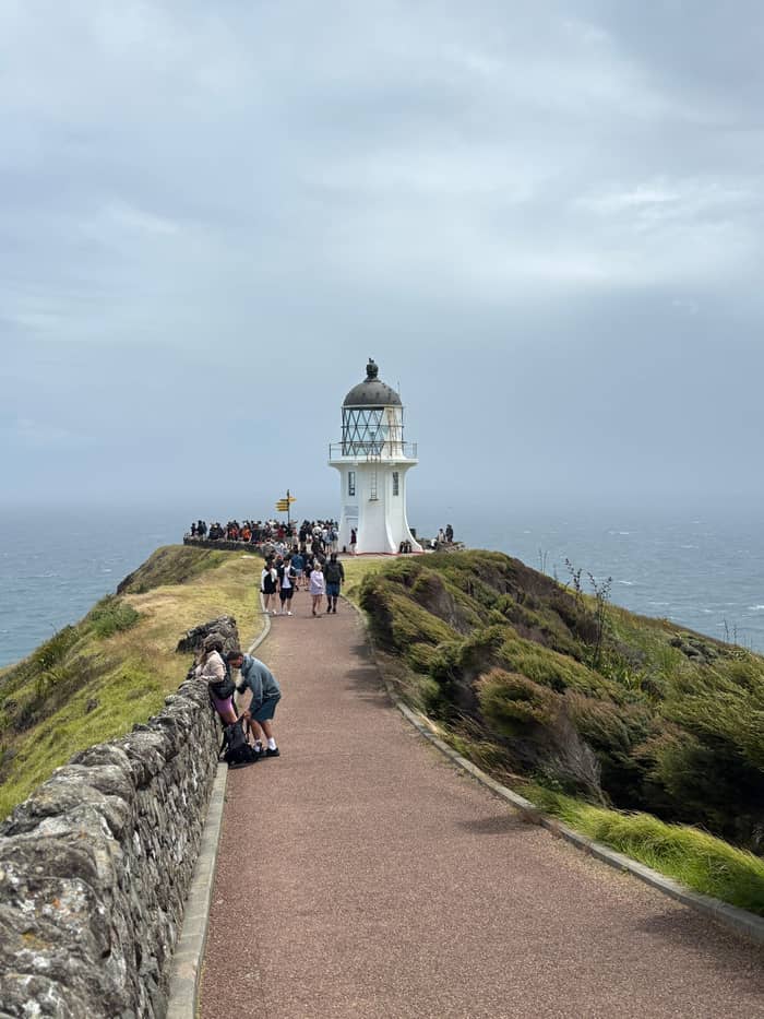
The white tower stands 165m above the sea at the end of an 800 m paved path from the car park.
Google MapsThe tip of the headland with the pōhutukawa Te Aroha; no food is eaten here.
Google MapsThe island where the first northern light stood; the stump of its old tower remains.
Google MapsThe headland west of the lighthouse, named by Abel Tasman for the wife of the Governor of Batavia.
Google MapsKapowairua, a bay with a DOC campsite at the eastern end of the coastal track.
Google MapsA campsite bay managed by Ngāti Kuri, the place DOC suggests for eating.
Google Maps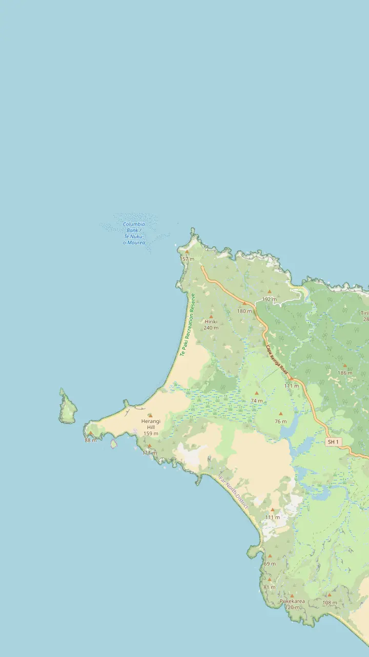
The white tower stands 165m above the sea at the end of an 800 m paved path from the car park.
Google MapsThe tip of the headland with the pōhutukawa Te Aroha; no food is eaten here.
Google MapsA long beach west of the cape, reached by a 2 km return track past steep cliffs.
Google MapsThe headland west of the lighthouse, named by Abel Tasman for the wife of the Governor of Batavia.
Google MapsThe island where the first northern light stood; the stump of its old tower remains.
Google MapsA campsite bay managed by Ngāti Kuri, the place DOC suggests for eating.
Google Maps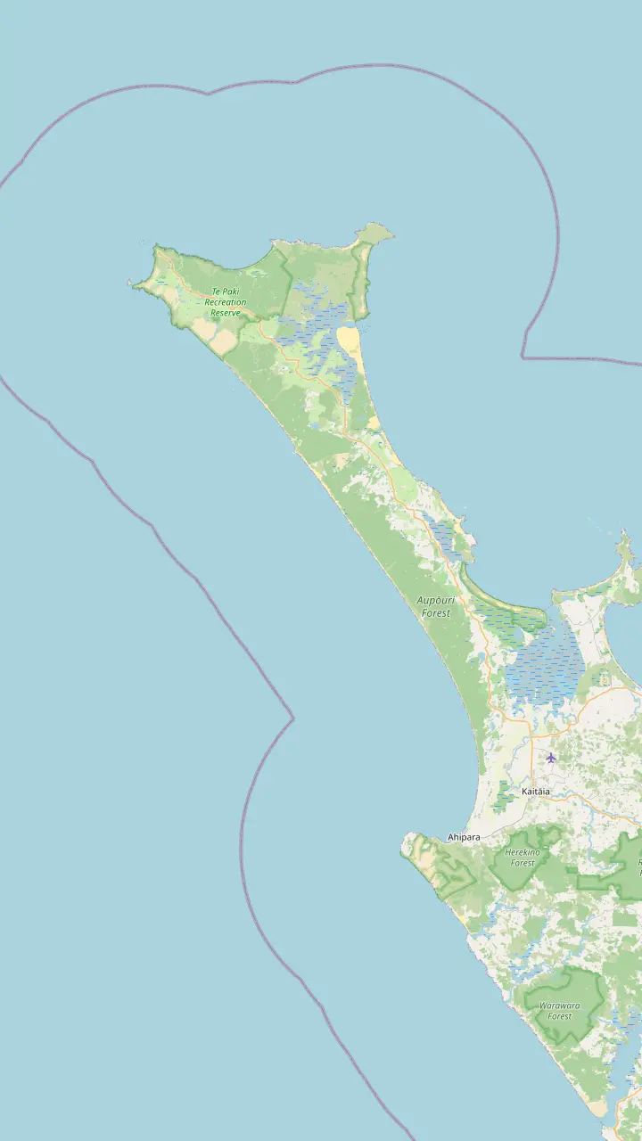
The popular vehicle exit from Ninety Mile Beach, open to 4WD vehicles only.
Google MapsGiant dunes around 150 m high, used for sandboarding; dogs are not permitted.
Google MapsA beach on the coastal track west of the cape where DOC has reported feral dogs.
Google MapsA beach landmark 51 km south of Te Paki Stream, where the Ngāti Kuri rohe meets the coast.
Google MapsA beach landmark 69 km south of Te Paki Stream.
Google MapsThe town at the southern end of the beach, known for sunsets and surf.
Google Maps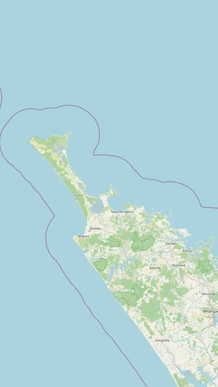
Bay of Islands town where the coach day to Cape Reinga starts.
Google MapsThe last major town before the top of the country, approximately 111 km south of the cape.
Google MapsA harbor settlement on the road north toward the cape.
Google MapsA small settlement on the road north, before Waitiki Landing.
Google MapsThe junction where the last 20 km of road to the cape begins.
Google MapsThe white tower stands 165m above the sea at the end of an 800 m paved path from the car park.
Google Maps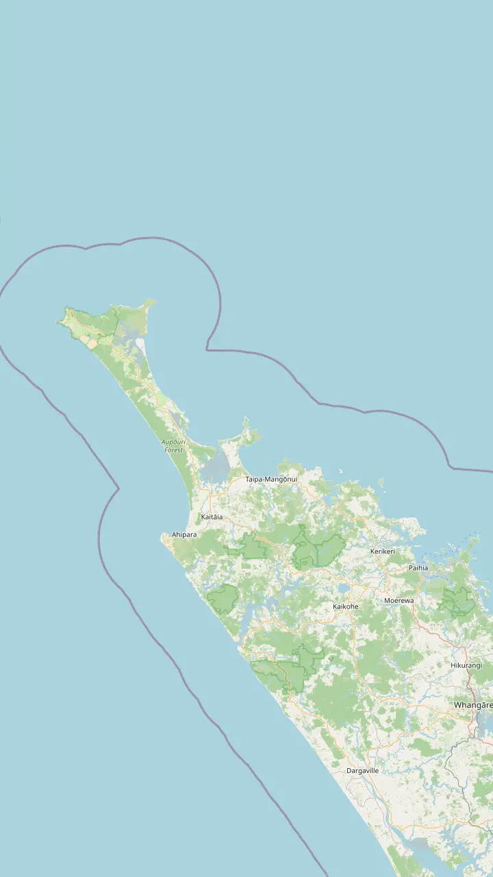
Bay of Islands town where the coach day to Cape Reinga starts.
Google MapsThe last major town before the top of the country, approximately 111 km south of the cape.
Google MapsThe town at the southern end of the beach, known for sunsets and surf.
Google MapsA small settlement on the road north, before Waitiki Landing.
Google MapsA campsite bay managed by Ngāti Kuri, the place DOC suggests for eating.
Google MapsKapowairua, a bay with a DOC campsite at the eastern end of the coastal track.
Google MapsThe junction where the last 20 km of road to the cape begins.
Google MapsMap data by © OpenStreetMap contributors
Where the oceans meet at Cape Reinga, the Tasman Sea and the Pacific Ocean push against each other over a shallow bank. Here is what you can really see, where to stand, and why the meeting matters.
Editorial team, capereingatour.top · Updated November 8, 2026 · A 7 min read
Summary view
Few places let you watch an ocean boundary from dry land, but Cape Reinga comes close. The Department of Conservation says Tasman and Pacific currents sweep around the headland and clash in a frothing, broken swell above the Columbia Bank, a little west of Te Rerenga Wairua.2 Stand at the lighthouse rail, look out to the west, and that churning patch of sea is the place you came to see.
Tourism New Zealand describes it as a spectacular swirl of currents, and Northland Inc says the seas visibly collide here.7,8 Both descriptions are fair on a lively day. DOC adds that the churning waves sometimes explode into spray and spume, which is the moment most photographers wait for.4 On a calm morning the effect is quieter, but the lines of white water still show where the currents clash.
For many visitors the meeting of the waters is the reason for the long drive. The question of where the oceans meet at Cape Reinga has a satisfying answer, because DOC puts a name and a place on it: the Columbia Bank, offshore from the cape.2 Few natural wonders are this easy to point at, and it helps to know what you are looking at before you arrive. Read the boards along the path on the way out, and the view will make more sense when you reach the rail.
West and east
| Side | Coast | Landmarks |
|---|---|---|
| Tasman, west | Wild and exposed | Cape Maria van Diemen |
| Tasman, west | Golden dunes | Te Werahi Beach |
| Pacific, east | More sheltered | Spirits Bay |
| Pacific, east | Sandy bays | Tapotupotu Bay |
| Offshore | Broken water | Columbia Bank |
So what oceans meet at Cape Reinga? The Tasman Sea lies to the west and the Pacific Ocean to the east. DOC describes the lighthouse as standing on a steep rocky cape lashed by the Tasman Sea on the west and the Pacific Ocean.1 Northland as a whole is a narrow peninsula no more than 18 km wide, bounded by these same waters, so the cape is simply where the land runs out between them.14
The difference shows on the coast as well as offshore. DOC notes that the eastern shore tends to be calmer, with sandy coves, while the west coast is wilder and more exposed, with spectacular golden dunes.15 Drive north along the peninsula and you can feel it: calm bays on one side, a surf-beaten beach on the other. At the cape, the two characters finally meet head on.16 Look at a map before you go and the shape of the peninsula explains a lot.
The pairing never changes: the Tasman, counted as a sea, against the Pacific, an ocean. Whatever words you choose, the scene from the rail is the same: swells rolling in from the west run into swells from the east, and the water between them turns white and restless for as far as you can see. Bring someone who has never seen it and watch their face.
Two oceans meet at Cape Reinga, as DOC puts it, with immense power.16 Even so, there is no neat stripe on the water, and anyone promising one is overselling. What you see is a zone of broken, foaming water where the swells from each side run into each other.3 On a windy day it is wide and obvious, with waves rearing up at odd angles. On a still day it can be subtle, a shift in texture and color more than a wall of white. Patience at the rail is usually rewarded with at least one big set of waves.
Weather makes a big difference. DOC warns that the headland is badly exposed, that conditions shift quickly and that strong winds blow often.21 On a blustery day the sea often looks livelier from the rail, even if the path feels unpleasant. Bring a warm layer, hold onto your hat and give it a few minutes: the sea rarely looks the same twice. Keep your camera strap around your wrist when the gusts arrive.
Visibility matters for the wider view. Clear air can reveal the Three Kings Islands as faint shapes on the skyline, DOC notes.23 Haze, sea spray and low cloud often hide them, so treat a sighting as a bonus. A pair of binoculars helps you pick out the breaking water over the bank and any seabirds working the currents. Zoom in with your phone or camera to bring the white water closer.
Plan the view
Wind, light and time decide what the sea shows you.
If I want drama
Go on a windy day
Strong wind is common, and the sea often looks livelier then.21
If I want calm
Go early or late
DOC finds the cape quietest away from 11 am to 3 pm.22
If I want the islands
Pick a clear day
The Three Kings show only when the air is clear.23
If I want both coasts
Take a scenic flight
Flights from the Bay of Islands follow both coasts.24
If I want a guide
Join the coach day
The Paihia day names the lighthouse among its stops.
Viewpoints
Classic view
End of the paved path
Quieter
Down toward the beach
Both coasts
Scenic flight
The meeting of the seas is beautiful from the cliff and dangerous from a deck. DOC explains that a lighthouse was first built on Motuopao Island to keep ships safe in the rough and dangerous seas off the top of New Zealand.28 The light later moved to the headland, and today its 1000-watt bulb sends a warning 49 km out to sea.48,17 For many crews it is the first light of New Zealand they spot.17
The sea here has taken ships. The collier Kaitawa went down near Cape Reinga on 23 May 1966, and none of her 29 crew survived.13 DOC says westerlies reaching 43 knots and heavy seas pushed her onto the northern end of the Pandora Bank, where she broke up.49 Remember that loss when you stand at the rail on a rough day and watch the white water. The ocean here deserves respect as well as admiration.
The sea is no safer close to shore. DOC warns that the beaches around the reserve have rough seas, strong currents and water that gets deep quickly, and that rogue waves and surges are a risk when fishing or walking near the coast.50,51 If you want to swim, DOC says the safest places are the lagoons and estuaries beside the campsites.52 Keep the swimming for those calm, sheltered spots. Ask what seas meet at Cape Reinga and sailors would have named the same pair that troubled them here.
See it with a guide
Set your group size and compare ways to reach the cape.
Compare 3 alternatives
Set your group size and compare ways to reach the cape.
≈
View≈
View≈
ViewAll amounts are from-prices on GetYourGuide, converted at the ECB reference rate. Exact prices are shown at booking.
Ships at the meeting point
1642
Abel Tasman sights the Far North coast.9
1643
Tasman stops for water and names the islands.10
1769
Both sight the north coast.9
1772
Anchors in Spirits Bay for fresh water.11
May 1941
Cape Reinga lighthouse first used.12
1966
The collier sinks with all hands.13
For Māori, this is more than a meeting of waters. Northland Inc describes the leaping place of the spirits as both a departing place and a meeting place of great oceans.6 DOC explains that, after death, Māori spirits journey north along the coast to the pōhutukawa standing on the headland.53 The sea below is part of that journey, not just scenery. The interpretation boards on the path tell more of the story.54
In the account DOC makes public, the spirits pass beneath the sea to the Three Kings Islands, say a final goodbye and go home to their ancestral land.55 For Ngāti Kuri, the iwi of this land, Manawatāwhi (the Three Kings) is where spirits rest a final time before departing Aotearoa.56,55 Those islands are the dots you may see on the horizon on a clear day. Look for those far specks of land when the air is clear.23
That meaning shapes how to behave here. Ngāti Kuri call Te Rerenga Wairua the most sacred place in their rohe, and DOC's guidance is that no food is eaten on the headland, while water is fine.57,33 Watch the oceans in a quiet spirit, keep voices low near the headland, and leave nothing behind. You will see more for having slowed down. Many visitors find the quiet is what they remember most.
Video
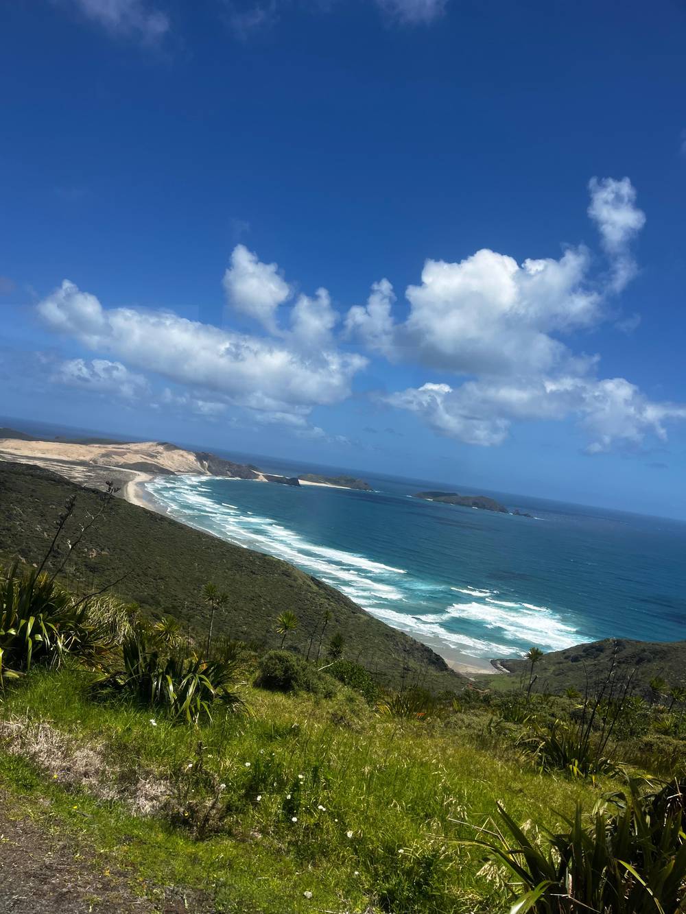
Glen And Mado on YouTube · Until you tap play, no video is loaded.
At times, the churning waves erupt in explosions of spray and spume.
Watching the sea
The lighthouse viewing area is the best seat. It sits at the end of an 800 m path from the car park, about 10 min on foot.5 From the rail, look west for Cape Maria van Diemen and Motuopao Island, and on the eastern side to Spirits Bay and the cliffs of de Surville.19 The Columbia Bank lies offshore to the west of the cape, so face the Tasman side.2 Stay inside the viewing area rather than edging toward the cliff for a better picture.47
Crowds follow the clock. The midday hours from 11 am to 3 pm are the busiest, DOC says, as are the weeks from late December to early January; dawn and late afternoon are calmer.22 DOC also links to a NIWA forecast for the cape, which is worth checking for wind before you set off.46 The car park is shut overnight, from 8.30pm to 7am.58 If the forecast is wild, that may be the day to go.
For a different angle, take the track west from the lighthouse walk down to Te Werahi Beach, a 45 min round trip of 2 km.25 Whales visit Otangawhiti, Sandy Bay, along the coast to the east, which DOC says is known for frequent whale visits.59 For the widest view of both coasts at once, scenic flights from the Bay of Islands fly to the cape and along both coastlines.24 Each viewpoint shows the meeting from a different side, so pick the one that suits your time and legs.
FAQ
DOC describes the cape as lashed by the Tasman Sea to the west and the Pacific Ocean.1
DOC places the meeting above the Columbia Bank, a short way west of Te Rerenga Wairua.2
It is 800 m from the car park, about 10 min on foot.5
Northland Inc calls it a departing place for spirits and a meeting place of oceans.6
DOC says you may see them on the distant horizon when the air is clear.23
Sources
Heading for the top of the North Island? Ask a real person here.