Easy
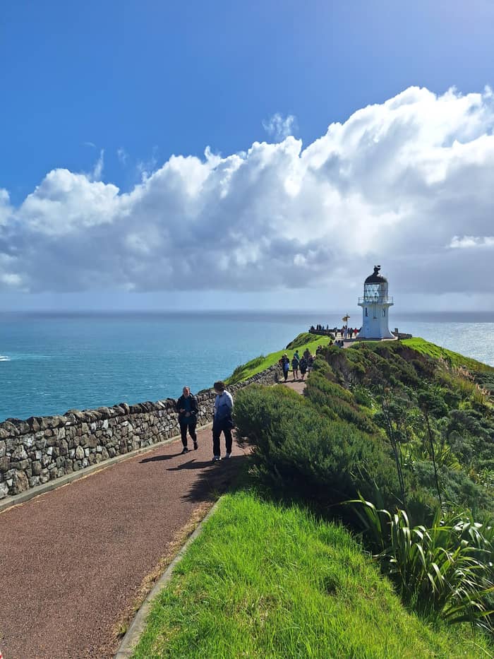
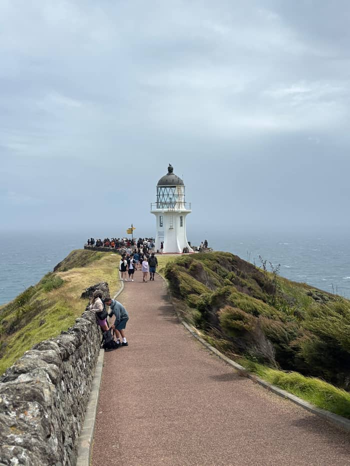
Lighthouse path
Paved, past the portico
- One way800 m
- Time10 min
- SuitsChildren and buggies
Where is your stop
Map of 18 stops
First pick a route, then tap any pin or stop for details and Google Maps.
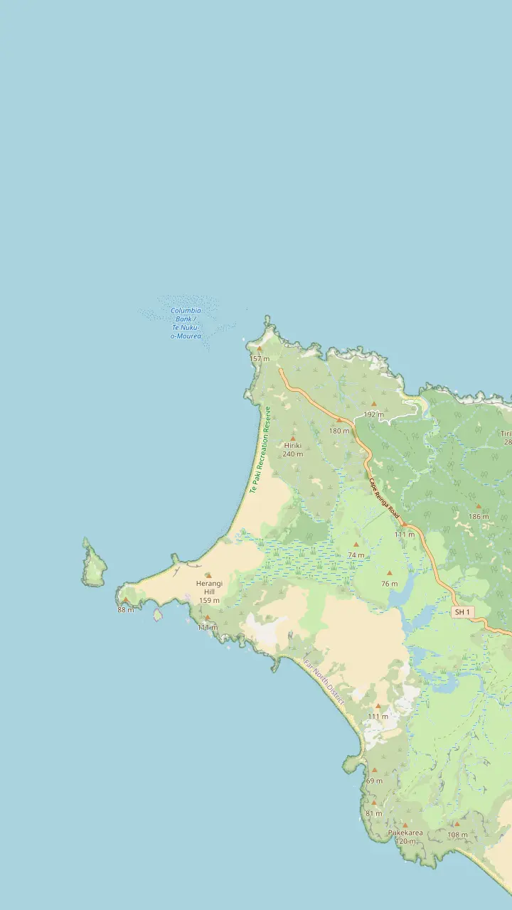
The white tower stands 165m above the sea at the end of an 800 m paved path from the car park.
Google MapsThe tip of the headland with the pōhutukawa Te Aroha; no food is eaten here.
Google MapsA long beach west of the cape, reached by a 2 km return track past steep cliffs.
Google MapsThe headland west of the lighthouse, named by Abel Tasman for the wife of the Governor of Batavia.
Google MapsThe island where the first northern light stood; the stump of its old tower remains.
Google MapsA campsite bay managed by Ngāti Kuri, the place DOC suggests for eating.
Google Maps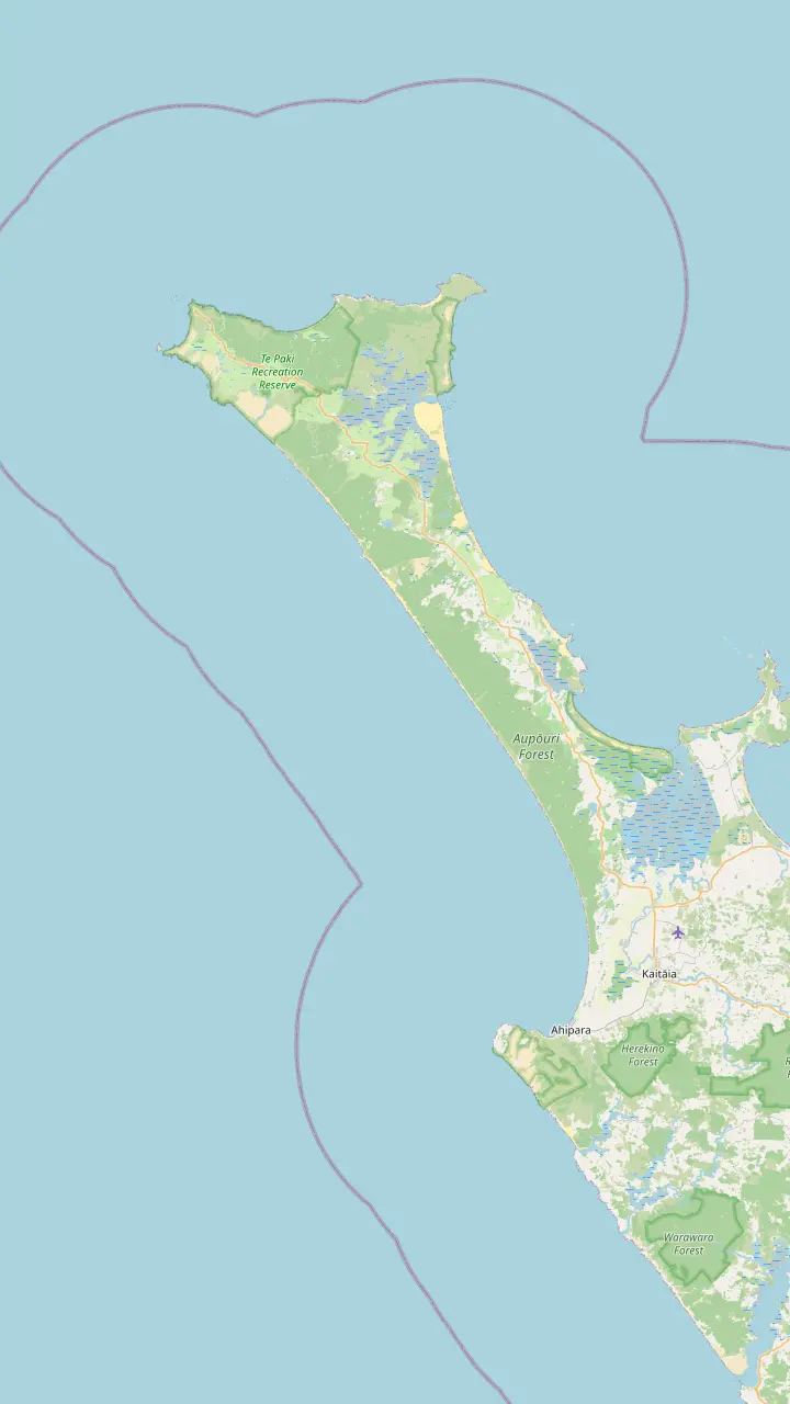
The popular vehicle exit from Ninety Mile Beach, open to 4WD vehicles only.
Google MapsGiant dunes around 150 m high, used for sandboarding; dogs are not permitted.
Google MapsA beach on the coastal track west of the cape where DOC has reported feral dogs.
Google MapsA beach landmark 51 km south of Te Paki Stream, where the Ngāti Kuri rohe meets the coast.
Google MapsA beach landmark 69 km south of Te Paki Stream.
Google MapsThe town at the southern end of the beach, known for sunsets and surf.
Google Maps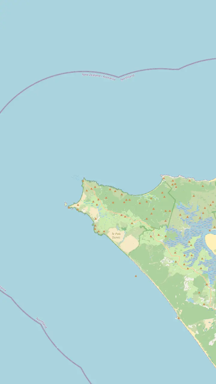
The white tower stands 165m above the sea at the end of an 800 m paved path from the car park.
Google MapsThe tip of the headland with the pōhutukawa Te Aroha; no food is eaten here.
Google MapsThe island where the first northern light stood; the stump of its old tower remains.
Google MapsThe headland west of the lighthouse, named by Abel Tasman for the wife of the Governor of Batavia.
Google MapsKapowairua, a bay with a DOC campsite at the eastern end of the coastal track.
Google MapsA campsite bay managed by Ngāti Kuri, the place DOC suggests for eating.
Google Maps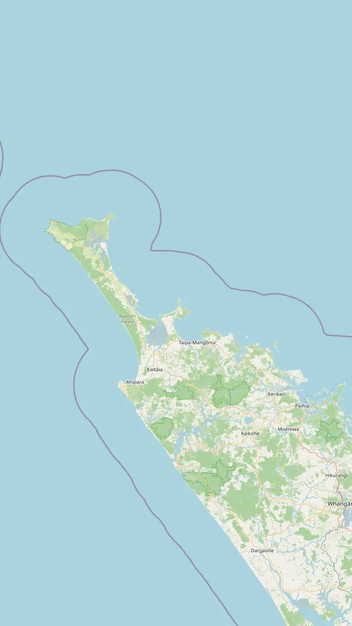
Bay of Islands town where the coach day to Cape Reinga starts.
Google MapsThe last major town before the top of the country, approximately 111 km south of the cape.
Google MapsA harbor settlement on the road north toward the cape.
Google MapsA small settlement on the road north, before Waitiki Landing.
Google MapsThe junction where the last 20 km of road to the cape begins.
Google MapsThe white tower stands 165m above the sea at the end of an 800 m paved path from the car park.
Google Maps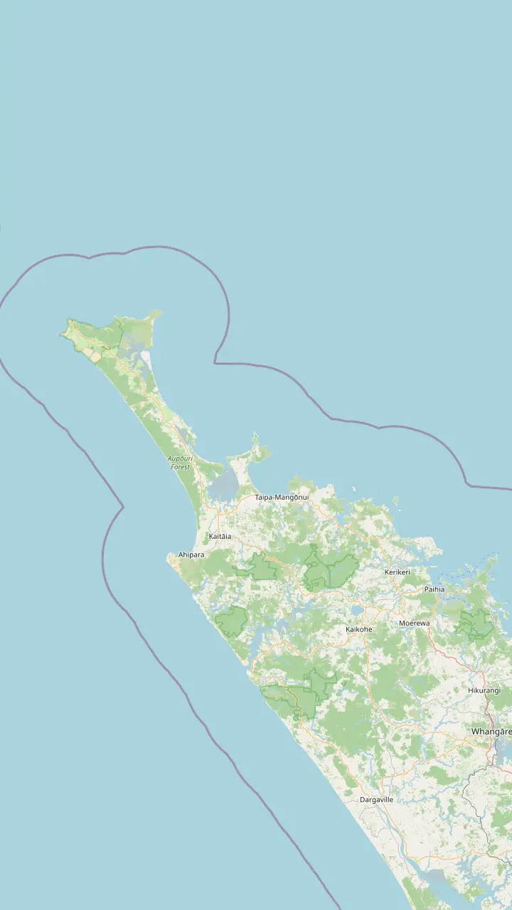
Bay of Islands town where the coach day to Cape Reinga starts.
Google MapsThe last major town before the top of the country, approximately 111 km south of the cape.
Google MapsThe town at the southern end of the beach, known for sunsets and surf.
Google MapsA small settlement on the road north, before Waitiki Landing.
Google MapsA campsite bay managed by Ngāti Kuri, the place DOC suggests for eating.
Google MapsKapowairua, a bay with a DOC campsite at the eastern end of the coastal track.
Google MapsThe junction where the last 20 km of road to the cape begins.
Google MapsMap data by © OpenStreetMap contributors
The Cape Reinga lighthouse sits at the end of a paved path on a sacred headland. Here is how long the walk takes, how the light came here, what you see from the rail and how to behave while you are there.
Editorial team, capereingatour.top · Updated November 8, 2026 · A 8 min read
Summary view
The Cape Reinga lighthouse is the picture most people carry home from the Far North, and it is smaller than many expect. The white tower measures 10m from base to lantern, but it stands 165m above sea level on a steep headland, so it reads as tall against the sky.2 Below it, the land simply stops, and the water churns in every direction you look. A wide-angle lens earns its keep up here.
It also marks the end of the road in a literal sense. Tourism New Zealand notes that North Cape reaches a little further north, yet as a scientific reserve it stays off limits to visitors, which leaves Cape Reinga as the top of the country most travelers can reach.5 The State Highway runs out at a car park, and from there everyone continues on foot along the same path. Fill the tank well before you get here.
The headland matters for more than the view. The Department of Conservation says no place in New Zealand holds deeper spiritual meaning for Māori than Cape Reinga, and an ancient pōhutukawa and a lonely lighthouse are the landmarks it names on the headland.6,7 Come for the light and the sea, but walk the path knowing you are a guest on sacred ground. That respect shapes the rules on this page.
Read the view
| Look | What you see | Note |
|---|---|---|
| West | Cape Maria van Diemen | Named by Abel Tasman |
| West | Motuopao Island | Site of the first light |
| East | Spirits Bay | Campsite and long beach |
| East | de Surville Cliffs | Northern tip of the island |
| Offshore | Columbia Bank | Where the currents meet |
| Far north | Three Kings Islands | Only on a clear day |
Directions and names as the Department of Conservation gives them at the lighthouse.20,21,8,22,23
So how long is the walk to Cape Reinga lighthouse? The Department of Conservation gives it as 800 m one way and about 10 min, graded an easy short walk.1 DOC adds that it suits children and buggies, and that this stretch is the first piece of Te Araroa, the long trail down the country.11 Allow longer than the signpost suggests, because almost everyone stops to read the panels and look.
The path is paved but not flat. DOC warns that some steep sections may defeat some wheelchair users, and that bollards placed to keep vehicles out leave a gap of 860 mm with a right-angle turn.12 If you need that access opened, DOC lists the Ngāti Kuri Facilities Services Helpdesk on 0800 837 254.13 Ring before the day, not from the car park, where reception may be patchy.14 Plan accessible visits with time to spare.
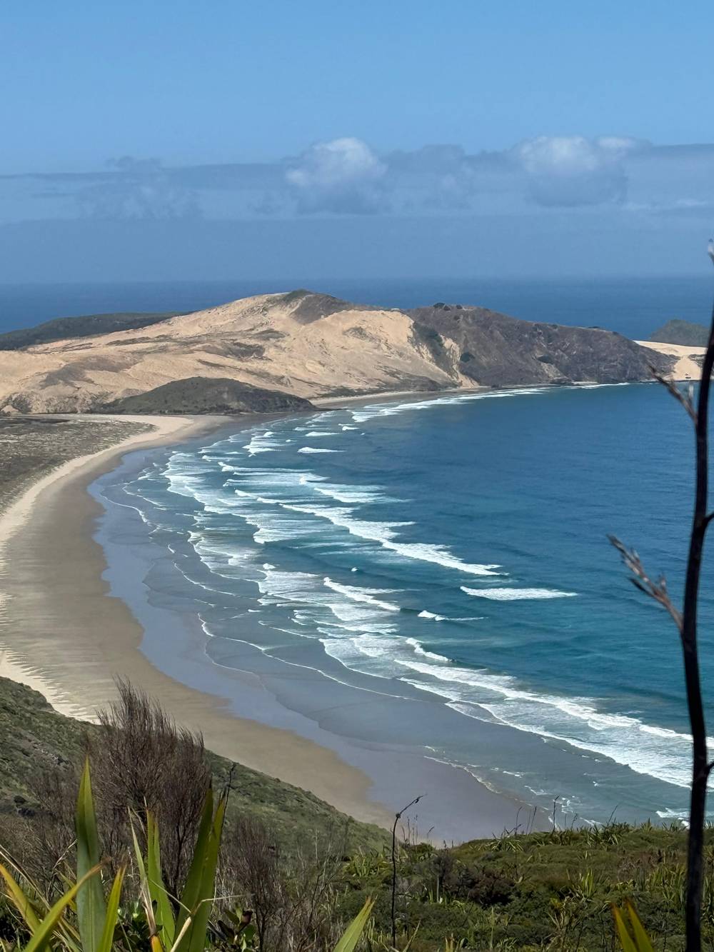
Near the start you pass under a concrete portico, a waharoa or gateway, which at first reveals only slices of Cape Maria van Diemen and Motuopao Island.15 Step through and the whole coast opens out, with Te Werahi Beach curving away below.16 Along the way, interpretation boards cover the rocks, the plants, the history and the culture of the place, so the walk doubles as an open-air lesson.17
The Cape Reinga lighthouse history begins offshore. Motuopao Island, off Cape Maria van Diemen, was first judged the best site for a light to guard ships rounding the rough waters at the top of New Zealand.8 By the start of the Second World War that choice looked wrong, and the decision was made to move the light.9 The island tower was left behind, and the light went to the mainland.
In 1941 the glasshouse and the light mechanism were lifted off the island tower and rebuilt at a new lighthouse settlement on the headland at Te Rerenga Wairua.10 The new light shone for the first time in May 1941, and it became the last lighthouse with resident keepers to be built in the country.2 The stump of the old tower still stands at the northern end of Motuopao.26 Few lights in the country have moved so far.
Keepers stayed until 1987, when the last one was withdrawn and the light was switched to electric running.3 Today the light is watched remotely by computer from Wellington, far to the south.3 What you see is therefore a working aid to navigation without a keeper, and the visit is simply the tower, the rail and the view. Keep that simplicity in mind and the short visit makes sense.
Plan your visit
Your time, your legs and the crowds decide it.
If I want it quiet
Go early or late
Midday, 11 am to 3 pm, is the peak window DOC names.24
If I have little time
Walk to the light and back
The path is 800 m one way, about 10 min.1
If I want a proper walk
Take the Te Werahi Beach track
If I am pushing a buggy
Stay on the main path
If I do not want to drive
Join a coach day
The Paihia day trip names the lighthouse among its stops.
Walks from the car park
Easy
Paved, past the portico
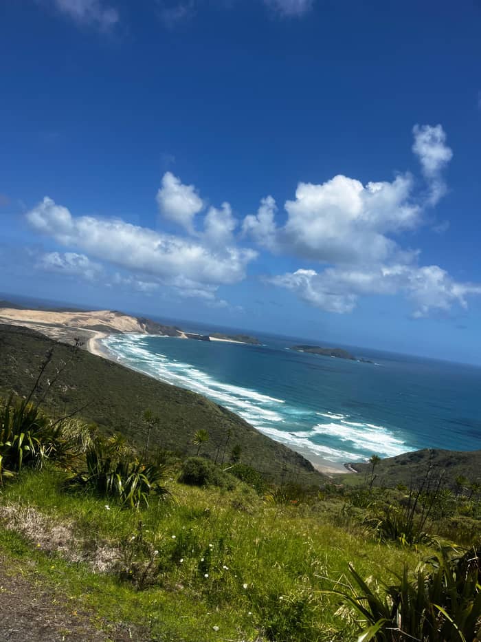
Moderate
Down the cliffs to the west
Longer
Coastal track to the east
Cape Reinga lighthouse facts are best told through the light itself. Its 1000-watt bulb, magnified by the lens, throws a warning 49 km out to sea, and DOC notes it is often the first New Zealand light that sailors see.3 That reach matters where Tasman and Pacific water collide over the Columbia Bank, on the western side of the cape.22 From the rail, look west toward that broken water.
The danger is not theoretical. On 23 May 1966 the collier Kaitawa was lost near Cape Reinga with all 29 hands.46 DOC records that she drifted onto the north end of the Pandora Bank in westerly winds of up to 43 knots and heavy seas, and was wrecked.47 Stand at the rail on a windy day and the broken water offshore makes the purpose of the tower plain. A wreck like that is why the light exists.
Because the light is automatic and run from Wellington, there is no keeper to show you round, and the experience is about the setting. Look for the lantern turning on a grey afternoon, and notice how the sea changes color across the bank. If you arrive early or late in the day, note that the car park is locked from 8.30pm until 7am, DOC says, so plan to be out of the car park before then.43
Go with a guide
Choose how many are going and compare lighthouse day trips.
Compare 3 alternatives
Choose how many are going and compare lighthouse day trips.
≈
View≈
View≈
ViewAll amounts are from-prices on GetYourGuide, converted at the ECB reference rate. Exact prices are shown at booking.
The light's story
Early choice
Chosen first to guard ships in the rough northern waters.8
Wartime
By the start of the Second World War the site was judged wrong.9
1941
Glasshouse and light mechanism rebuilt at Te Rerenga Wairua.10
May 1941
No later keeper-watched light was built in the country.2
1987
The last keeper withdrawn; the light runs on electricity.3
Today
Managed remotely by computer from Wellington.3
The viewing area is a compass of names. Westward you see Cape Maria van Diemen with Motuopao Island off its tip; eastward the view runs to Spirits Bay and the de Surville Cliffs, the northernmost point of the North Island.20 Abel Tasman named Cape Maria van Diemen in honor of the wife of the Governor of Batavia.21 On a clear day DOC says you may spot the Three Kings Islands far out on the horizon.23 Pack binoculars for the far headlands.
Straight ahead is the show most people come for. DOC describes Tasman and Pacific currents colliding in a frothing swell above the Columbia Bank, and at times the waves burst into spray.48,49 There is no painted line in the water, but on a lively day you can watch the seas pushing against each other across the bank. Watch for a few minutes: the pattern shifts with every set of waves, and the colors change with the light.
Turn back toward the portico before you leave. Its inner panels reproduce a historical map, believed to be the earliest known map of Aotearoa, which Tuki Tahua drew over 200 years ago.50 Even the roof has a story, built from certified sustainable eucalypt and cedar.51 It is easy to walk past both on the way in, so save them for the slower walk back to the car park. The panels reward a slow look.
Video
Kritz Travel TV Plus on YouTube · Until you tap play, no video is loaded.
As you walk through the portico, the entire vista opens up before you, and Te Werahi Beach appears.
Before you walk
Cape Reinga is Te Rerenga Wairua, the place from which Māori spirits are said to leave, and DOC asks visitors to follow tikanga here.52 Leave food uneaten until you are off the headland; DOC says sipping water is fine.4 If you need a meal, DOC suggests Tapotupotu, a 5-10 min drive on a gravel road, which has toilets.28 Keep snacks in the bag until you are back on the road. A packed lunch can wait for the beach.
There are no rubbish bins, so everything you bring comes back with you, and pets of any kind, dogs too, must stay away.45 Scattering or burying ashes is another thing DOC asks visitors not to do here, since the cape is a sacred place where that is not appropriate.53 Stay on the paved track and in the viewing area, and keep a hand on small children: the drop-offs around the lighthouse are steep.44 These requests come from the iwi who look after the cape.
Timing changes the mood completely. DOC reports the heaviest crowds from late December into early January, and daily from 11 am to 3 pm; it suggests the start or the end of the day instead.24 If you drive yourself, aim for the edges of the day. The wind is a constant here, so bring a warm layer even in summer.42 Sunglasses help on bright days, when the glare off the sea is strong and the white tower dazzles.
The lighthouse path is the start, not the end, of the walking here. A side track drops west from the lighthouse walk past steep cliffs to Te Werahi Beach, 2 km return and about 45 min.18,25 It is a fine way to escape the crowds at the rail, but the climb back up is steady, and DOC warns of steep drop-offs toward the ocean, so supervise children closely. Wear shoes with grip for the sandy sections.
Eastward, a coastal section links the cape to Tapotupotu Bay: 5 km one way, about 3 hr.19 It climbs steeply at the Tapotupotu end, with views back to the lighthouse and toward Manawatāwhi, the Three Kings Islands.54 Both tracks belong to the Te Paki Coastal Track, a 48 km route with four campsites along the way.55 Carry plenty of water on the longer tracks. Start early in the day if you plan the full walk.
For some walkers, the lighthouse is the first step of a far longer journey. Te Araroa is a continuous 3,000 km walking trail from Cape Reinga to Bluff, and Northland Inc says most of its through-walkers start at the cape.56,57 If you see people with heavy packs taking photos at the signpost, there is a good chance they are setting off on months of walking south. A nod and a word of luck are always welcome.
FAQ
DOC gives the path as 800 m one way, about 10 min, an easy short walk from the car park.1
Vehicles stop at the car park; bollards on the track keep them out, leaving an 860 mm gap.12
DOC lists the gate closure as 8.30pm to 7am.43
Sources
Heading for the top of the North Island? Ask a real person here.