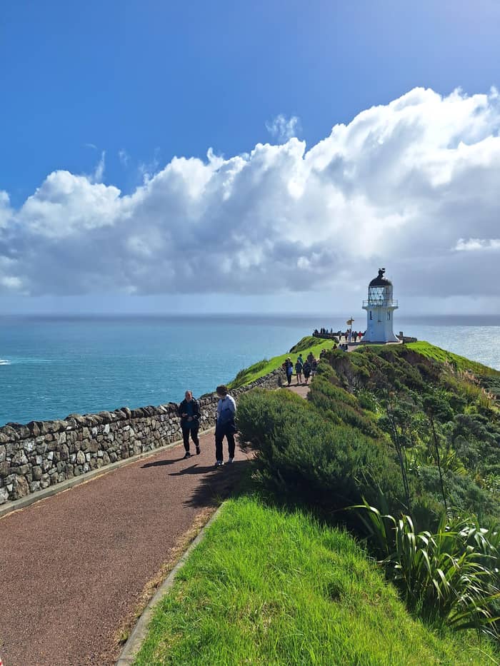
Own timing
Self-drive
Highway only, no beach
- Paihia to Kaitaia118 km
- Kaitaia to cape111 km
- BeachNot in a rental
Where is your stop
The short version
You can drive from Paihia to Cape Reinga via Kaitaia and State Highway 1, but rental cars may not go on Ninety Mile Beach, so the beach is for tours and 4WDs.
Driving essentials
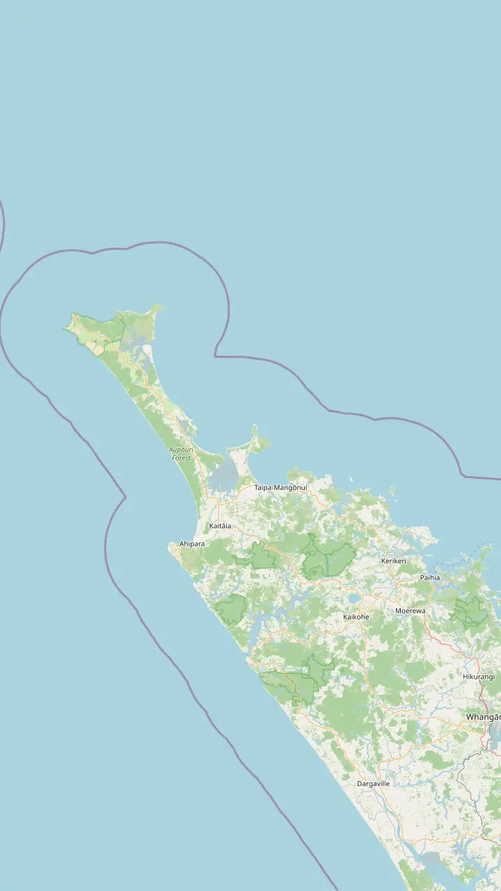
Map of 18 stops
First pick a route, then tap any pin or stop for details and Google Maps.
Bay of Islands town where the coach day to Cape Reinga starts.
Google MapsThe last major town before the top of the country, approximately 111 km south of the cape.
Google MapsA harbor settlement on the road north toward the cape.
Google MapsA small settlement on the road north, before Waitiki Landing.
Google MapsThe junction where the last 20 km of road to the cape begins.
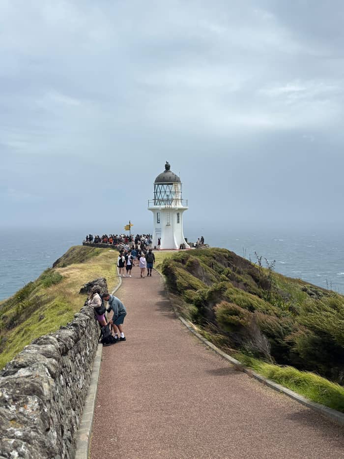
Google MapsThe white tower stands 165m above the sea at the end of an 800 m paved path from the car park.
Google Maps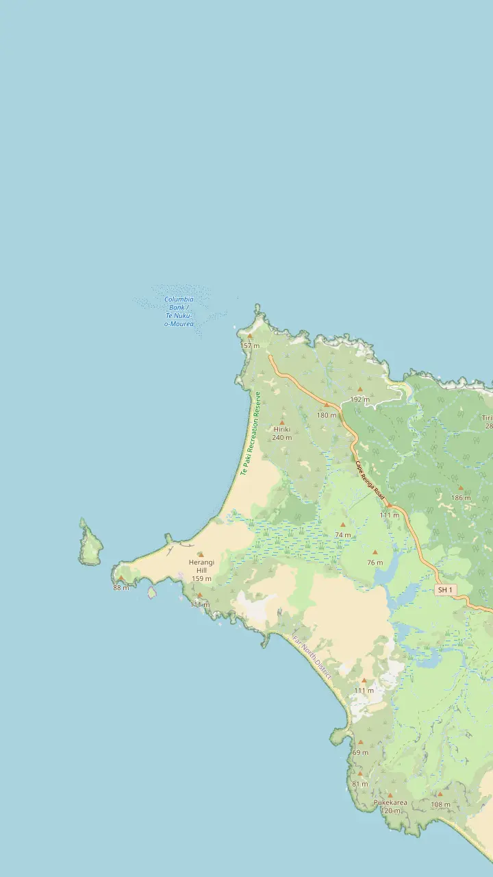
The white tower stands 165m above the sea at the end of an 800 m paved path from the car park.
Google MapsThe tip of the headland with the pōhutukawa Te Aroha; no food is eaten here.
Google MapsA long beach west of the cape, reached by a 2 km return track past steep cliffs.
Google MapsThe headland west of the lighthouse, named by Abel Tasman for the wife of the Governor of Batavia.
Google MapsThe island where the first northern light stood; the stump of its old tower remains.
Google MapsA campsite bay managed by Ngāti Kuri, the place DOC suggests for eating.
Google Maps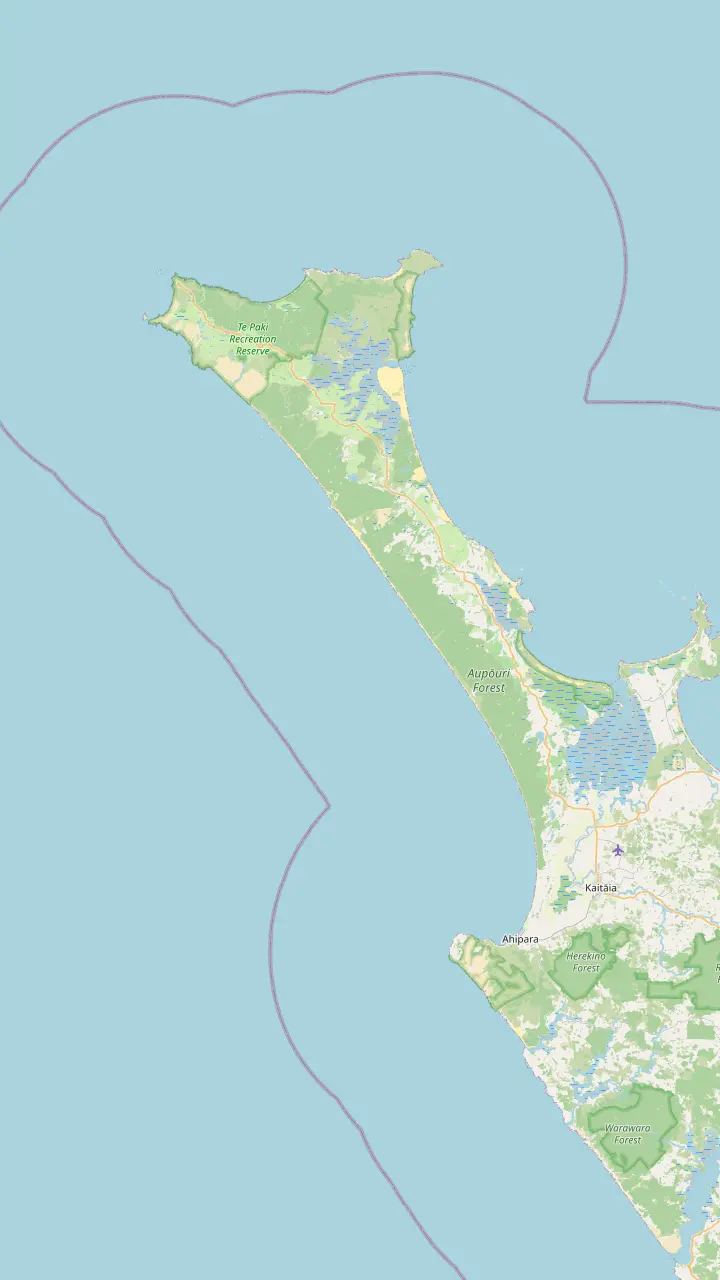
The popular vehicle exit from Ninety Mile Beach, open to 4WD vehicles only.
Google MapsGiant dunes around 150 m high, used for sandboarding; dogs are not permitted.
Google MapsA beach on the coastal track west of the cape where DOC has reported feral dogs.
Google MapsA beach landmark 51 km south of Te Paki Stream, where the Ngāti Kuri rohe meets the coast.
Google MapsA beach landmark 69 km south of Te Paki Stream.
Google MapsThe town at the southern end of the beach, known for sunsets and surf.
Google Maps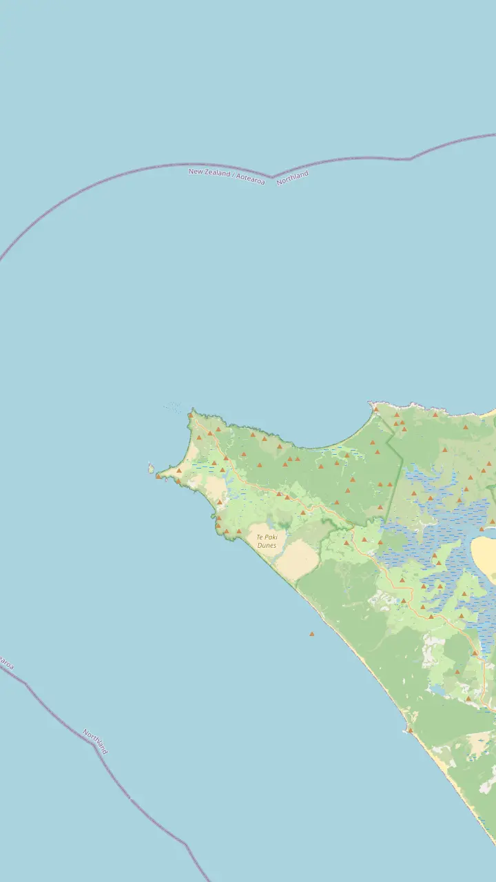
The white tower stands 165m above the sea at the end of an 800 m paved path from the car park.
Google MapsThe tip of the headland with the pōhutukawa Te Aroha; no food is eaten here.
Google MapsThe island where the first northern light stood; the stump of its old tower remains.
Google MapsThe headland west of the lighthouse, named by Abel Tasman for the wife of the Governor of Batavia.
Google MapsKapowairua, a bay with a DOC campsite at the eastern end of the coastal track.
Google MapsA campsite bay managed by Ngāti Kuri, the place DOC suggests for eating.
Google Maps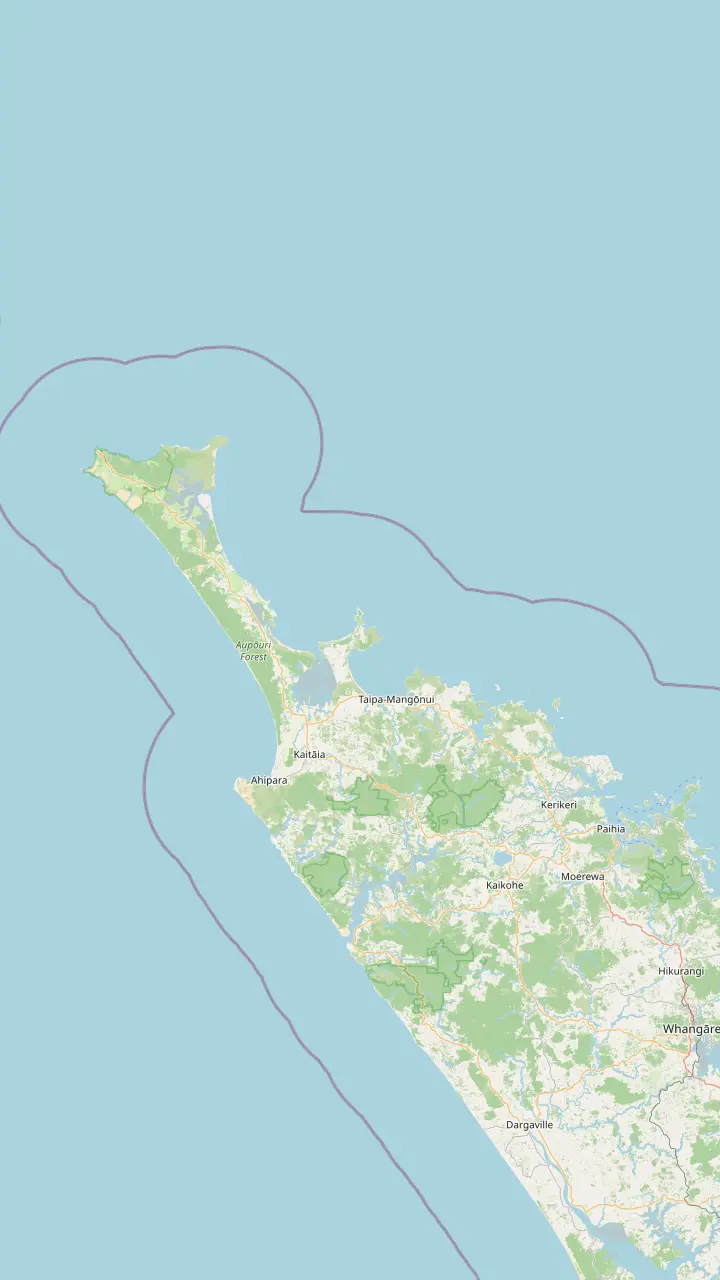
Bay of Islands town where the coach day to Cape Reinga starts.
Google MapsThe last major town before the top of the country, approximately 111 km south of the cape.
Google MapsThe town at the southern end of the beach, known for sunsets and surf.
Google MapsA small settlement on the road north, before Waitiki Landing.
Google MapsA campsite bay managed by Ngāti Kuri, the place DOC suggests for eating.
Google MapsKapowairua, a bay with a DOC campsite at the eastern end of the coastal track.
Google MapsThe junction where the last 20 km of road to the cape begins.
Google MapsMap data by © OpenStreetMap contributors
You can drive yourself to the top of New Zealand, but not the way the tour bus goes. Here is the highway route, what the beach rules mean for a rental car, and what to plan for.
Editorial team, capereingatour.top · Updated November 8, 2026 · A 7 min read
Yes. Can you drive to Cape Reinga in an ordinary car? Also yes, by the highway. The Department of Conservation sends drivers up State Highway 1 to Waitiki Landing and then another 20 km to the cape, which sits about 111 km north of Kaitaia.2 The road ends at a car park, and the lighthouse walk starts there.7
What you cannot easily drive is the beach. Ninety Mile Beach is officially a highway, says Tourism New Zealand, passable only in a 4WD and only at particular tides, and car hire firms rule it out for their fleets.4 The tour buses use the beach with vehicles built for it; a self-drive trip keeps to the highway and leaves the sand alone.
The other thing to plan around is time at the top. Overnight, between 8.30pm and 7am, the car park gates stay shut, and the department does not allow camping on the headland.5,8 Driving yourself gives you the freedom to come early or late, which is exactly when the headland is quietest.9 A coach tour arrives on its own schedule, often in the busy middle hours; a car lets you choose, and on a summer morning that choice changes the whole feel of the place.
Turn-offs
| Place | Turn-off | Road |
|---|---|---|
| Te Paki Stream | About 5 km north of Waitiki14 | 4km gravel14 |
| Tapotupotu Bay | 2 km south of the cape15 | About 3 km gravel15 |
| Spirits Bay | At Waitiki Landing18 | About 16 km18 |
| Cape Reinga | 20 km past Waitiki2 | State Highway 12 |
Check rental insurance before driving gravel roads, as Northland Inc advises.6
How far is Cape Reinga from Paihia? Tourism New Zealand puts Paihia to Kaitaia at 118 km and about 1 h 40 min via State Highway 10.1 From Kaitaia it is a further 111 km north to the cape, a drive that Tourism New Zealand times at about 1.5 hours each way.2,3 Allow extra time for stops and summer traffic on the final stretch.
Along the way, the Department of Conservation marks a few useful distances. Te Paki, where the dune road leaves the highway, is about 96 km north of Kaitaia.13 Te Paki Stream Road turns off about 5 km north of Waitiki and runs 4km on gravel to the car park by the dunes.14 Tapotupotu Bay is signposted 2 km before the cape, then about 3 km of gravel.15
A Paihia to Cape Reinga self-drive is therefore a full day in the car if you go up and back, before any stops. You can split it with a night in Kaitaia, Ahipara or further north, and approach the cape fresh the next morning. If you are staying in Paihia and want a single day, the coach day takes 11 hours with a guide doing the driving.
The beach is the part many people dream of driving, and the part rental contracts forbid. Safety is the main reason hire companies keep their vehicles off the sand, according to Tourism New Zealand.4 The Te Paki Stream entrance, at the north end, is also a popular way on and off the beach for cars and tourist buses, according to the Department of Conservation.19
Northland Inc adds a related warning: if you drive a rental, check that your insurance still applies on gravel roads.6 The road to the Te Paki Stream car park is gravel, and so is the road to Tapotupotu.14,15 Read your contract before you turn off the highway, not after. If your policy excludes gravel, park at the highway and skip the side road, or plan those stops for a day when you join a tour instead.
If riding the sand is the reason you came, book the tour. The coach day drives the beach in a 46-seat bus built for it, subject to tide and weather. Tourism New Zealand also calls a coach tour the easy way to drive the beach, from Kaitaia or from Paihia.4 On the tour you also get the stream crossing at Te Paki and the dune stop without worrying about tides, soft sand or a stuck wheel far from help.
Drive or ride
Find your situation and see whether the car or the bus fits better.
If Riding the sand is the whole point
Take the tour
A rental agreement keeps your car off the beach.4
If I want the cape without crowds
Drive and go early
DOC finds it calmer at dawn and towards evening.9
If I want to camp near the cape
Drive to Tapotupotu
No camping at the cape; Tapotupotu is the nearest campground.8
If I do not want to drive rural roads
Take the tour
The coach day from Paihia does the driving in 11 hours.
If I have a 4WD and local know-how
Check the tides first
The beach is safe only at specific times of the tide.4
Three ways up
Own timing
Highway only, no beach
Our pick
From Paihia, with lunch
Air and road
From the Bay of Islands
Tourism New Zealand names Kaitaia the gateway town of the far north, and the regional agency sees it as the place to load up on supplies.10,41 Fill the tank there. Fuel stops are spread thin up here, and so are cafes, the agency cautions.6,42 A full tank and a full stomach in Kaitaia turn the last stretch from a worry into a pleasure.
North of Kaitaia the services thin out. Te Kao has a general store, but the peninsula is short on services, so plan the day before setting out.11 Pack a picnic for later, since meals are not eaten on the headland, and Tapotupotu, a 5 to 10 minute drive away on gravel, has toilets and is the place DOC suggests for a meal.27,12
There are no rubbish bins at the cape, so take everything back out with you, and leave pets at home: they are not allowed there.39 The Te Paki Stream car park by the dunes has toilets.43 Mobile reception in Te Paki is limited, so download maps and tell someone your plans.37 Fill your water bottles in Kaitaia too: the Department of Conservation asks you to boil or treat tap water at the campsites up here, and a full bottle saves the bother.44
The road north
Leave Paihia
118 km to Kaitaia, about 1 h 40 min.1
Kaitaia
The last major town before the top.10
Te Kao
Services are limited further north.11
Waitiki Landing
Another 20 km on SH1 to the cape.2
Cape Reinga
800 m each way to the lighthouse.7
Tapotupotu
A 5 to 10 minute drive on gravel.12
The car park at the cape is the end of the road. Its gates are closed between 8.30pm and 7am, which rules out sunset-to-sunrise visits in the long summer evenings if you linger too late.5 The Department of Conservation also warns that Cape Reinga Road gets very busy in summer and asks drivers to slow down and take care.17
Look after the car while you walk. The department notes thefts from vehicles in the Te Paki area and advises against leaving a vehicle unattended while you walk.40 Keep valuables out of sight, lock up, and take your phone and water to the lighthouse. A busy summer day brings coaches, campervans and day-trippers into a small car park, so patience helps, and an early arrival makes parking easy.
The walk itself is 800 m each way and takes about 10 minutes.7 Cliffs drop steeply close to the light, so stay on the hard path and keep children close.38 Wind is common and the weather changes quickly, so take a jacket even on a fine morning.45 Allow at least an hour at the top for the walk, the lookouts and the views, more if you want to sit quietly by the lighthouse and watch the oceans meet.
Video
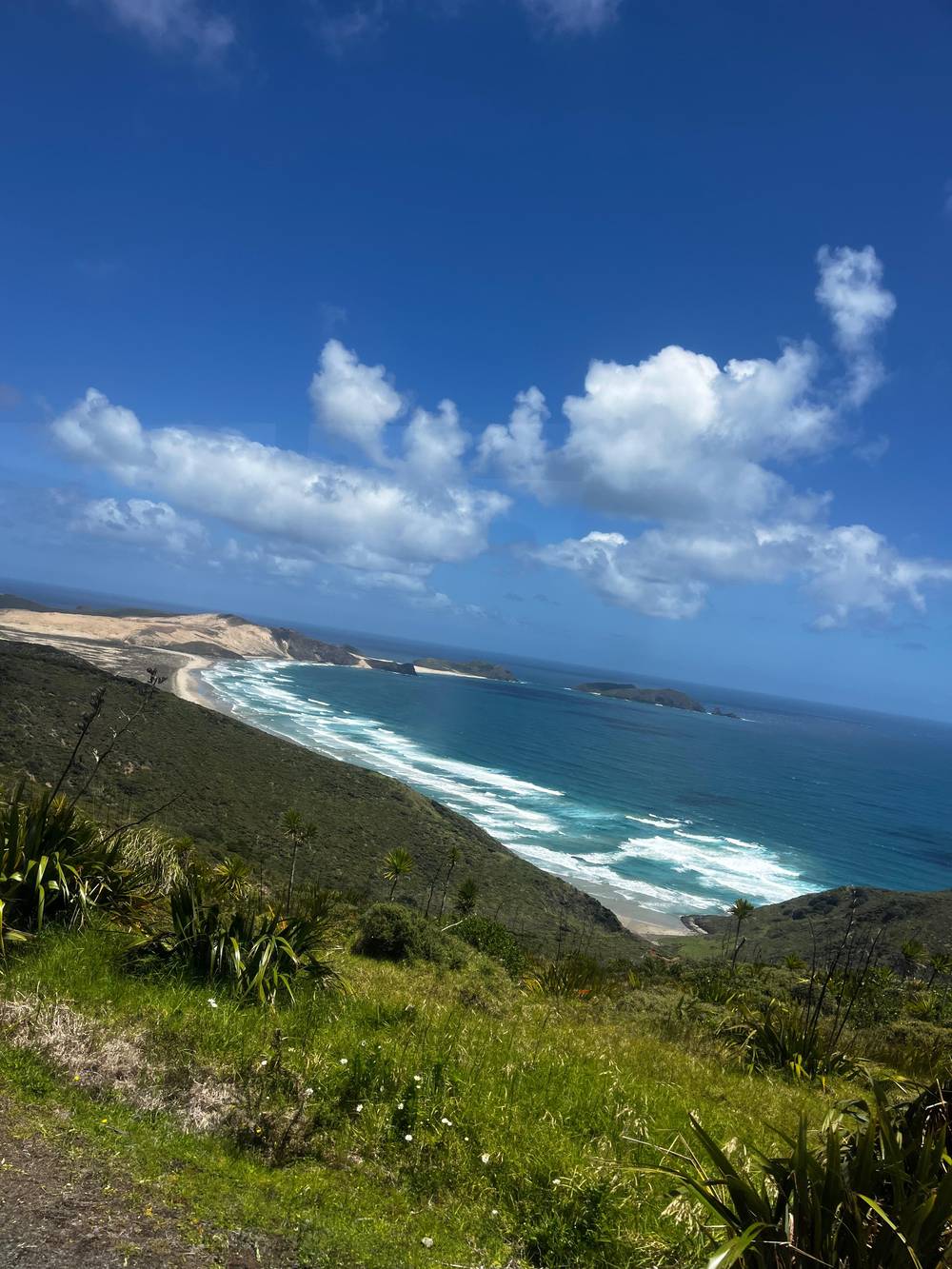
Emma and Matt on YouTube · Until you tap play, no video is loaded.
This beach is officially a highway, but is really only suitable for 4WD vehicles and is safe to drive only at specific times of the tides. Rental companies won’t allow their cars on the sand, mostly for safety reasons.
Self-drive checklist
Coach services connect Auckland with Northland, and InterCity reaches Kaitaia from Paihia in about 2 h 30 min.46,1 Beyond Kaitaia, the practical options are tours. Guided coaches run up from Kaitaia and from Paihia, Tourism New Zealand notes, and light aircraft fly scenic trips out of the bay.3,47 The bus timetables are built for towns, not headlands, so a car-free traveler reaches the cape on an organised trip rather than a regular service.
From Paihia the coach day fills 11 hours, lunch included, with the sand drive and dune boarding when the weather plays along. A small-group day lists pickups at the Bay of Islands i-SITE, a service station in Taipa and more, for up to 11 guests. Both remove the questions of fuel, gravel and insurance in one go.
Kaitaia departures run in summer, according to Northland Inc, so check your dates.48 If you are already in Kaitaia, a tour from there spends less time on the highway and more at the stops. If you are in Paihia, the coach collects you at the operator office in town. Either way, book ahead in summer, when the far north is at its busiest and the front seats go first.
Drive yourself if you want the headland in its calmer hours, as DOC advises, by arriving soon after the gates open or late in the afternoon.9 Drive if you want to camp at Tapotupotu, walk part of the Te Paki Coastal Track or stop at every bay along the way.49,50 A car also lets you follow the weather: if the cape is in cloud, you can wait it out at the dunes or a beach and drive up when it clears.
Take the tour if you want the beach. For a visitor without a 4WD, a tour is the practical way onto Ninety Mile Beach, and the regional tourism agency singles out the guided coach with its beach leg.4,51 Take it too if you would rather not drive long rural roads after a late night or a long flight. The commentary on board fills in the history you would otherwise miss from behind the wheel.
You can also combine both: drive to Kaitaia or Ahipara, sleep there, and join a tour from Kaitaia in summer, or take the coach day from Paihia and drive yourself on another trip. The map above shows the road north, the towns along it and the turn-offs to the dunes and Tapotupotu. Tap a pin to open it in Google Maps and check the drive time from where you are staying.
FAQ
Follow SH1 north to Waitiki Landing, then another 20 km to the car park at the cape.2
Tourism New Zealand says hire firms forbid their cars on the beach.4
The gates to the car park are closed between 8.30pm and 7am.5
Sources
Heading for the top of the North Island? Ask a real person here.